

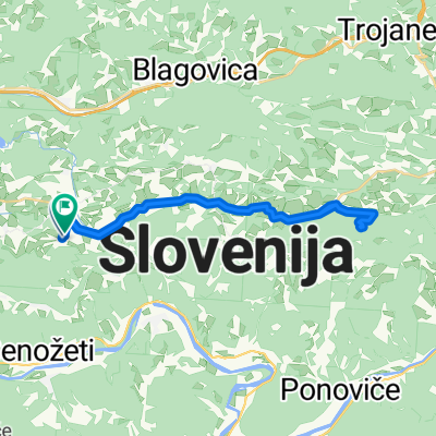
Krašce - "Mozirski gaj"
A cycling route starting in Moravče, Občina Moravče, Slovenia.
Overview
About this route
Krašce - Imenje - Lukovica - Trojane - Vransko - Šentrupert - Letuš - Mozirje - Mozirski gaj - Mozirje - ... - Krašce
- -:--
- Duration
- 112.9 km
- Distance
- 697 m
- Ascent
- 696 m
- Descent
- ---
- Avg. speed
- ---
- Max. altitude

Route quality
Waytypes & surfaces along the route
Waytypes
Quiet road
12.4 km
(11 %)
Access road
2.3 km
(2 %)
Surfaces
Paved
33.9 km
(30 %)
Unpaved
2.3 km
(2 %)
Asphalt
33.9 km
(30 %)
Ground
2.3 km
(2 %)
Undefined
76.8 km
(68 %)
Continue with Bikemap
Use, edit, or download this cycling route
You would like to ride Krašce - "Mozirski gaj" or customize it for your own trip? Here is what you can do with this Bikemap route:
Free features
- Save this route as favorite or in collections
- Copy & plan your own version of this route
- Split it into stages to create a multi-day tour
- Sync your route with Garmin or Wahoo
Premium features
Free trial for 3 days, or one-time payment. More about Bikemap Premium.
- Navigate this route on iOS & Android
- Export a GPX / KML file of this route
- Create your custom printout (try it for free)
- Download this route for offline navigation
Discover more Premium features.
Get Bikemap PremiumFrom our community
Other popular routes starting in Moravče
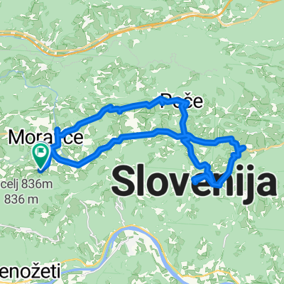
 Češnjice-Javoršica-Sv.Trojica-Češnjice
- Distance
- 19.8 km
- Ascent
- 577 m
- Descent
- 577 m
- Location
- Moravče, Občina Moravče, Slovenia
 Češnjice-Zasavska sveta gora in nazaj
- Distance
- 28.2 km
- Ascent
- 447 m
- Descent
- 448 m
- Location
- Moravče, Občina Moravče, Slovenia
 Moja trening pot
- Distance
- 33 km
- Ascent
- 342 m
- Descent
- 342 m
- Location
- Moravče, Občina Moravče, Slovenia
 Blagovica - Špilk - Trojane - Golčaj
- Distance
- 20.7 km
- Ascent
- 816 m
- Descent
- 817 m
- Location
- Moravče, Občina Moravče, Slovenia
 laze-janče
- Distance
- 5.6 km
- Ascent
- 599 m
- Descent
- 114 m
- Location
- Moravče, Občina Moravče, Slovenia
 Češnjice-Slivna
- Distance
- 26.5 km
- Ascent
- 449 m
- Descent
- 451 m
- Location
- Moravče, Občina Moravče, Slovenia
 2 test
- Distance
- 33.4 km
- Ascent
- 326 m
- Descent
- 325 m
- Location
- Moravče, Občina Moravče, Slovenia
 Krašce - "Mozirski gaj"
- Distance
- 112.9 km
- Ascent
- 697 m
- Descent
- 696 m
- Location
- Moravče, Občina Moravče, Slovenia
Open it in the app