

Rando del Marrone 2013
A cycling route starting in Cuneo, Piedmont, Italy.
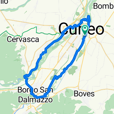
Overview
About this route
<span style="color: rgb(51, 51, 51); font-family: 'lucida grande', tahoma, verdana, arial, sans-serif; font-size: 13px; line-height: 17px;">Randonnèe del Marrone 2013</span>
- -:--
- Duration
- 136.6 km
- Distance
- 1,120 m
- Ascent
- 1,120 m
- Descent
- ---
- Avg. speed
- ---
- Max. altitude

Route quality
Waytypes & surfaces along the route
Waytypes
Busy road
53.8 km
(39 %)
Road
41.3 km
(30 %)
Surfaces
Paved
50 km
(37 %)
Unpaved
2.8 km
(2 %)
Asphalt
49.5 km
(36 %)
Unpaved (undefined)
2.1 km
(2 %)
Route highlights
Points of interest along the route
Point of interest after 22.6 km
Point of interest after 73.9 km
Continue with Bikemap
Use, edit, or download this cycling route
You would like to ride Rando del Marrone 2013 or customize it for your own trip? Here is what you can do with this Bikemap route:
Free features
- Save this route as favorite or in collections
- Copy & plan your own version of this route
- Split it into stages to create a multi-day tour
- Sync your route with Garmin or Wahoo
Premium features
Free trial for 3 days, or one-time payment. More about Bikemap Premium.
- Navigate this route on iOS & Android
- Export a GPX / KML file of this route
- Create your custom printout (try it for free)
- Download this route for offline navigation
Discover more Premium features.
Get Bikemap PremiumFrom our community
Other popular routes starting in Cuneo
 Giro a velocità lenta in Cuneo
- Distance
- 17.6 km
- Ascent
- 179 m
- Descent
- 178 m
- Location
- Cuneo, Piedmont, Italy
 01-Cuneo n° 1 with BIKEMAP! G
- Distance
- 32.8 km
- Ascent
- 166 m
- Descent
- 166 m
- Location
- Cuneo, Piedmont, Italy
 Da Corso Nizza 108, Cuneo a Corso Dante Livio Bianco 12, Valdieri
- Distance
- 17.7 km
- Ascent
- 219 m
- Descent
- 0 m
- Location
- Cuneo, Piedmont, Italy
 Chiusa Pesio
- Distance
- 38.4 km
- Ascent
- 408 m
- Descent
- 398 m
- Location
- Cuneo, Piedmont, Italy
 Percorso rilassato in Borgo San Dalmazzo
- Distance
- 8.6 km
- Ascent
- 165 m
- Descent
- 124 m
- Location
- Cuneo, Piedmont, Italy
 Percorso ciclabile anello Gesso e Stura
- Distance
- 26.6 km
- Ascent
- 189 m
- Descent
- 189 m
- Location
- Cuneo, Piedmont, Italy
 La Fausto Coppi
- Distance
- 108 km
- Ascent
- 2,416 m
- Descent
- 2,416 m
- Location
- Cuneo, Piedmont, Italy
 Giro a velocità costante in Cuneo del 04/09/2019
- Distance
- 18 km
- Ascent
- 177 m
- Descent
- 145 m
- Location
- Cuneo, Piedmont, Italy
Open it in the app