Die flachen 100km
- 98.7 km
- 499 m
- 499 m
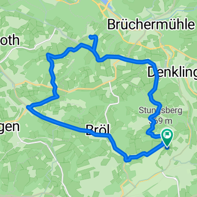
- Waldbröl, North Rhine-Westphalia, Germany
A cycling route starting in Waldbröl, North Rhine-Westphalia, Germany.
Overview
About Wiehl-Oberwiehl-Mittelagger-Eckenhagen (Blockhaus) - Tillkausen - Wildbergerhütte - Obersteimel - Brüchermühle - Waldbröl
Challenging road cycling route with over 1000Hm created this 12 years ago
Route quality
Quiet road
12.6 km
(18 %)
Road
6.3 km
(9 %)
Paved
30.8 km
(44 %)
Unpaved
0.7 km
(1 %)
Asphalt
30.1 km
(43 %)
Concrete
0.7 km
(1 %)
Continue with Bikemap
You would like to ride Standardrunde 2 or customize it for your own trip? Here is what you can do with this Bikemap route:
Free trial for 3 days, or one-time payment. More about Bikemap Premium.
Discover more Premium features.
Get Bikemap PremiumFrom our community
Open it in the app