

Bergetappe entlang Pala Gruppe (c.a. 3340 hm)
A cycling route starting in Pozza di Fassa, Trentino-Alto Adige, Italy.
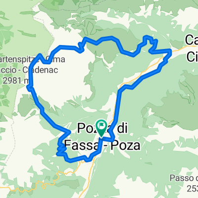
Overview
About this route
Throughout the entire route, you ride against a magnificent Dolomite backdrop. Starting point Pozza di Fassa (1320 m above sea level). From there, you descend the Fassa Valley to Moena. In the Val di Fiemme, you continue on to Predazzo (1018 m above sea level). Here begins the ascent to Passo di Rolle. In Bellamonte (1372 m above sea level), you reach an intermediate destination, followed by a few nearly flat kilometers along the Paneveggio Reservoir. At the fork to Passo Valles, the incline increases again. However, the gradient is evenly distributed and you can quickly find a nice rhythm (overall: length of 21 km and an elevation gain of 966 meters / average gradient 4.6%). Above the tree line, the steep rock faces of the Pala group offer an impressive panorama. The descent in the upper part features some tight hairpin bends and a partly damaged surface. In the valley town of Fiera di Primiero (717 m above sea level), the climb to the second pass, the Cereda Pass (1369 m above sea level), already begins. This one is tough, as the first section crosses the 15% mark several times, making it hard to find a rhythm. After two short descents and two counter climbs, you find yourself at the small Forcella Aurine Pass (1299 m above sea level). You ride this almost traffic-free road through picturesque villages and can truly experience nature. Then it goes downhill to Agordo. From there, the route continues mostly on a gently ascending road to Cencenighe. Here begins the hard climb to the San Pellegrino Pass (1918 m above sea level). Before Mas, you pass through two tunnels about 1000 meters long, both well lit (you should still bring reflective strips or LED rear lights). The gradient remains moderate initially; in the village of Falcade, a short, almost flat section offers a chance to recover. Up to Falcade Alto, it then becomes steeper and more winding. At the turnoff to Passo Valles, it gets serious; now it really gets hard, as indicated by a sign showing 15%. For about 2.5 kilometers, this gradient is maintained, even climbing up to 18%. In the upper section, it flattens again, and after leaving the forest, you ride towards the beautiful pass summit with a small chapel against a magnificent backdrop. This is followed by a fast but slightly damaged descent to Moena. After Pozza di Fassa, approximately 140 meters of elevation still need to be conquered.
- -:--
- Duration
- 137 km
- Distance
- 3,714 m
- Ascent
- 3,605 m
- Descent
- ---
- Avg. speed
- 1,976 m
- Max. altitude
Route quality
Waytypes & surfaces along the route
Waytypes
Quiet road
9.6 km
(7 %)
Cycleway
5.5 km
(4 %)
Surfaces
Paved
104.1 km
(76 %)
Asphalt
82.2 km
(60 %)
Paved (undefined)
21.9 km
(16 %)
Undefined
32.9 km
(24 %)
Route highlights
Points of interest along the route
Point of interest after 49.7 km
Point of interest after 136.7 km
Unterkunft (Startpunkt)
Continue with Bikemap
Use, edit, or download this cycling route
You would like to ride Bergetappe entlang Pala Gruppe (c.a. 3340 hm) or customize it for your own trip? Here is what you can do with this Bikemap route:
Free features
- Save this route as favorite or in collections
- Copy & plan your own version of this route
- Split it into stages to create a multi-day tour
- Sync your route with Garmin or Wahoo
Premium features
Free trial for 3 days, or one-time payment. More about Bikemap Premium.
- Navigate this route on iOS & Android
- Export a GPX / KML file of this route
- Create your custom printout (try it for free)
- Download this route for offline navigation
Discover more Premium features.
Get Bikemap PremiumFrom our community
Other popular routes starting in Pozza di Fassa
 Pozza di Fassa
- Distance
- 4.2 km
- Ascent
- 45 m
- Descent
- 43 m
- Location
- Pozza di Fassa, Trentino-Alto Adige, Italy
 Catinaccio Principe fast
- Distance
- 35.4 km
- Ascent
- 1,638 m
- Descent
- 1,637 m
- Location
- Pozza di Fassa, Trentino-Alto Adige, Italy
 Breve giro attorno al Media
- Distance
- 0.5 km
- Ascent
- 4 m
- Descent
- 4 m
- Location
- Pozza di Fassa, Trentino-Alto Adige, Italy
 Dag 3 origineel
- Distance
- 87.1 km
- Ascent
- 1,768 m
- Descent
- 1,768 m
- Location
- Pozza di Fassa, Trentino-Alto Adige, Italy
 Sella Ronda - 4 Pässe vom Feinsten
- Distance
- 88.2 km
- Ascent
- 2,783 m
- Descent
- 2,706 m
- Location
- Pozza di Fassa, Trentino-Alto Adige, Italy
 Pista Ciclabile Val di Fiemme e Fasso: A
- Distance
- 11.2 km
- Ascent
- 80 m
- Descent
- 274 m
- Location
- Pozza di Fassa, Trentino-Alto Adige, Italy
 Da Via Donato Zeni 15, Pozza di Fassa a Via Roma 54, Canazei
- Distance
- 11.4 km
- Ascent
- 57 m
- Descent
- 20 m
- Location
- Pozza di Fassa, Trentino-Alto Adige, Italy
 Valle San Nicolò
- Distance
- 7 km
- Ascent
- 505 m
- Descent
- 0 m
- Location
- Pozza di Fassa, Trentino-Alto Adige, Italy
Open it in the app