

2013 Ride Day 30 - Estancarbon (St-Gaudens) to Tarbes
A cycling route starting in Saint-Gaudens, Occitanie, France.
Overview
About this route
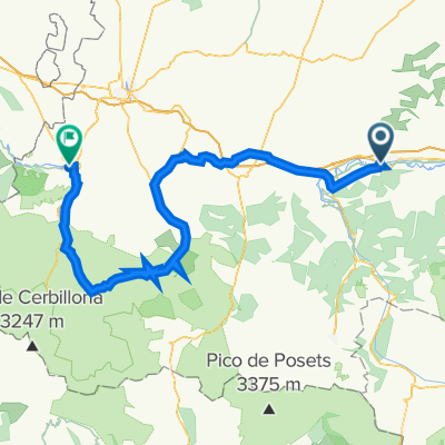
This was a hard ride as we crossed innumerable small creeks that required our descending to the creek and then climbing over the next hill to descend to the next creek. It was, though, a ride through some simply beautiful countryside on mostly very low traffic roads
- -:--
- Duration
- 92 km
- Distance
- 874 m
- Ascent
- 938 m
- Descent
- ---
- Avg. speed
- ---
- Max. altitude

Route quality
Waytypes & surfaces along the route
Waytypes
Road
78.2 km
(85 %)
Quiet road
3.7 km
(4 %)
Undefined
10.1 km
(11 %)
Surfaces
Paved
35 km
(38 %)
Asphalt
31.3 km
(34 %)
Paved (undefined)
3.7 km
(4 %)
Undefined
57 km
(62 %)
Continue with Bikemap
Use, edit, or download this cycling route
You would like to ride 2013 Ride Day 30 - Estancarbon (St-Gaudens) to Tarbes or customize it for your own trip? Here is what you can do with this Bikemap route:
Free features
- Save this route as favorite or in collections
- Copy & plan your own version of this route
- Split it into stages to create a multi-day tour
- Sync your route with Garmin or Wahoo
Premium features
Free trial for 3 days, or one-time payment. More about Bikemap Premium.
- Navigate this route on iOS & Android
- Export a GPX / KML file of this route
- Create your custom printout (try it for free)
- Download this route for offline navigation
Discover more Premium features.
Get Bikemap PremiumFrom our community
Other popular routes starting in Saint-Gaudens
 2014 Ride Day 41 - St-Gaudens (Estancarbon) to Foix
- Distance
- 95.8 km
- Ascent
- 514 m
- Descent
- 498 m
- Location
- Saint-Gaudens, Occitanie, France
 2019-05 St-Gaudens (Estancarbon) to Foix
- Distance
- 95.4 km
- Ascent
- 450 m
- Descent
- 475 m
- Location
- Saint-Gaudens, Occitanie, France
 2019-04 St-Gaudens Circle to the South
- Distance
- 60.8 km
- Ascent
- 741 m
- Descent
- 741 m
- Location
- Saint-Gaudens, Occitanie, France
- ddjk
- Distance
- 67.7 km
- Ascent
- ---
- Descent
- ---
- Location
- Saint-Gaudens, Occitanie, France
 2014 Ride Day 86 - St-Gaudens to l'Isle Jourdain
- Distance
- 98.1 km
- Ascent
- 361 m
- Descent
- 587 m
- Location
- Saint-Gaudens, Occitanie, France
 Saint Gaudens- Barbastro
- Distance
- 203.1 km
- Ascent
- 3,092 m
- Descent
- 3,048 m
- Location
- Saint-Gaudens, Occitanie, France
 2016 Ride Day 55 - St-Gaudens to Pamiers
- Distance
- 118.8 km
- Ascent
- 544 m
- Descent
- 638 m
- Location
- Saint-Gaudens, Occitanie, France
 R19 Saint Gaudens - TOURMALET - Lourdes
- Distance
- 136.4 km
- Ascent
- 2,821 m
- Descent
- 2,839 m
- Location
- Saint-Gaudens, Occitanie, France
Open it in the app