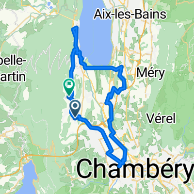
Chambéry -Alberville
A cycling route starting in La Motte-Servolex, Auvergne-RhĂ´ne-Alpes, France.
Overview
About this route
Entrainement pour aller de Chambéry à Alberville
- -:--
- Duration
- 67.5 km
- Distance
- 1,052 m
- Ascent
- 1,016 m
- Descent
- ---
- Avg. speed
- ---
- Avg. speed
Route quality
Waytypes & surfaces along the route
Waytypes
Busy road
32.3 km
(48 %)
Road
26.6 km
(39 %)
Surfaces
Paved
42.9 km
(64 %)
Unpaved
0.1 km
(<1 %)
Asphalt
42.9 km
(64 %)
Unpaved (undefined)
0.1 km
(<1 %)
Undefined
24.5 km
(36 %)
Continue with Bikemap
Use, edit, or download this cycling route
You would like to ride Chambéry -Alberville or customize it for your own trip? Here is what you can do with this Bikemap route:
Free features
- Save this route as favorite or in collections
- Copy & plan your own version of this route
- Sync your route with Garmin or Wahoo
Premium features
Free trial for 3 days, or one-time payment. More about Bikemap Premium.
- Navigate this route on iOS & Android
- Export a GPX / KML file of this route
- Create your custom printout (try it for free)
- Download this route for offline navigation
Discover more Premium features.
Get Bikemap PremiumFrom our community
Other popular routes starting in La Motte-Servolex
- 2012 French Tour -- Ride Day 36 -- 23 September 2012 -- Chambéry to Seyssins (Grenoble)
- Distance
- 75.6 km
- Ascent
- 1,821 m
- Descent
- 1,846 m
- Location
- La Motte-Servolex, Auvergne-RhĂ´ne-Alpes, France
- la motte pontcharra autour de l'outherand
- Distance
- 52.8 km
- Ascent
- 1,568 m
- Descent
- 1,590 m
- Location
- La Motte-Servolex, Auvergne-RhĂ´ne-Alpes, France
- maison barbiset epine relais epine maison
- Distance
- 45 km
- Ascent
- 1,436 m
- Descent
- 1,436 m
- Location
- La Motte-Servolex, Auvergne-RhĂ´ne-Alpes, France
- Rando des fruits VTT 15km
- Distance
- 15 km
- Ascent
- 277 m
- Descent
- 274 m
- Location
- La Motte-Servolex, Auvergne-RhĂ´ne-Alpes, France
- tour infernal diminué
- Distance
- 74.3 km
- Ascent
- 1,646 m
- Descent
- 1,645 m
- Location
- La Motte-Servolex, Auvergne-RhĂ´ne-Alpes, France
- 7-GRENOBLE
- Distance
- 102.9 km
- Ascent
- 2,757 m
- Descent
- 2,796 m
- Location
- La Motte-Servolex, Auvergne-RhĂ´ne-Alpes, France
- la motte pragondran traversée sousle nivolet
- Distance
- 40.1 km
- Ascent
- 1,047 m
- Descent
- 1,057 m
- Location
- La Motte-Servolex, Auvergne-RhĂ´ne-Alpes, France
- TourVTTGranier
- Distance
- 61.5 km
- Ascent
- 1,445 m
- Descent
- 1,446 m
- Location
- La Motte-Servolex, Auvergne-RhĂ´ne-Alpes, France
Open it in the app