

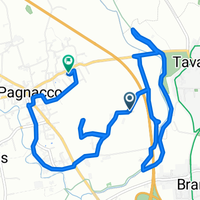
PAGNACCO - UDINE - SAN DANIELE PAGNACCO
A cycling route starting in Pagnacco, Friuli Venezia Giulia, Italy.
Overview
About this route
60 km between the Friulan plain in Udine and the hills of the prosciutto region in San Daniele del Friuli!!!!
- -:--
- Duration
- 71.4 km
- Distance
- 256 m
- Ascent
- 258 m
- Descent
- ---
- Avg. speed
- ---
- Max. altitude
Route quality
Waytypes & surfaces along the route
Waytypes
Road
22.1 km
(31 %)
Quiet road
12.8 km
(18 %)
Surfaces
Paved
42.8 km
(60 %)
Unpaved
0.7 km
(1 %)
Asphalt
42.8 km
(60 %)
Unpaved (undefined)
0.7 km
(1 %)
Undefined
27.8 km
(39 %)
Continue with Bikemap
Use, edit, or download this cycling route
You would like to ride PAGNACCO - UDINE - SAN DANIELE PAGNACCO or customize it for your own trip? Here is what you can do with this Bikemap route:
Free features
- Save this route as favorite or in collections
- Copy & plan your own version of this route
- Sync your route with Garmin or Wahoo
Premium features
Free trial for 3 days, or one-time payment. More about Bikemap Premium.
- Navigate this route on iOS & Android
- Export a GPX / KML file of this route
- Create your custom printout (try it for free)
- Download this route for offline navigation
Discover more Premium features.
Get Bikemap PremiumFrom our community
Other popular routes starting in Pagnacco
 Pagnacco-Flüelapass-Landquart-
- Distance
- 524.1 km
- Ascent
- 5,645 m
- Descent
- 5,284 m
- Location
- Pagnacco, Friuli Venezia Giulia, Italy
 Magnalonga Cormor
- Distance
- 19.1 km
- Ascent
- 158 m
- Descent
- 160 m
- Location
- Pagnacco, Friuli Venezia Giulia, Italy
 Da Via dei Gelsi 5, Pagnacco a Via Monte Canin 25, Pagnacco
- Distance
- 9.4 km
- Ascent
- 47 m
- Descent
- 25 m
- Location
- Pagnacco, Friuli Venezia Giulia, Italy
 giroPaolo
- Distance
- 27.5 km
- Ascent
- 96 m
- Descent
- 94 m
- Location
- Pagnacco, Friuli Venezia Giulia, Italy
 Da Via Braida di Ros 30–42, Borgo Marano a Strade dal Ciscjelàt, Buia
- Distance
- 21 km
- Ascent
- 231 m
- Descent
- 66 m
- Location
- Pagnacco, Friuli Venezia Giulia, Italy
 LIG - OBORZA
- Distance
- 102.6 km
- Ascent
- 1,112 m
- Descent
- 1,109 m
- Location
- Pagnacco, Friuli Venezia Giulia, Italy
 PAGNACCO - MONTE MATAJUR
- Distance
- 48 km
- Ascent
- 1,240 m
- Descent
- 86 m
- Location
- Pagnacco, Friuli Venezia Giulia, Italy
 PAGNACCO - UDINE - SAN DANIELE PAGNACCO
- Distance
- 71.4 km
- Ascent
- 256 m
- Descent
- 258 m
- Location
- Pagnacco, Friuli Venezia Giulia, Italy
Open it in the app