
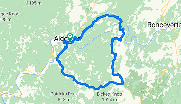
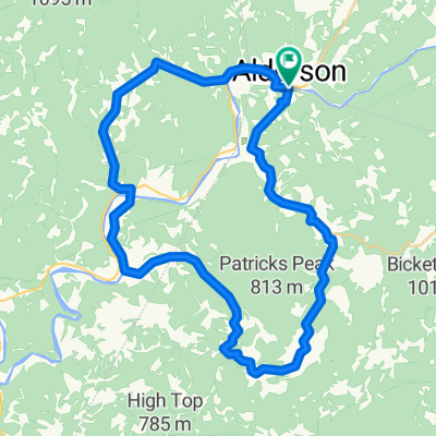
Muddy Creek Mtn. - Sinks Grove Loop
A cycling route starting in Alderson, West Virginia, United States.
Overview
About this route
Short, scenic and hilly route from Alderson, WV.
Turn only list: More detailed turn list follows. 0.0 0.0 Start: Riverside park along Greenbrier River in Alderson. Head East/North on Route 12. 0.3 0.3 Bare left to continue on Route 12. 0.8 0.5 Right on Muddy Creek Mtn. Road. Cty. 40 5.7 0.3 Right on Cty. 46. Continue Steep descent. 7.8 2.1 Right on State 63 7.9 0.1 Right on Cty. 43 10.5 0.4 Right on Cty. 58 11.4 0.9 Left on Cty. 58/1 Longanacre Road. 13.5 2.1 Right on Cty. 43/2 Scott Hollow Road. 16.6 3.1 Right on Cty. 5. 17.5 0.9 Right on State 3. 29.2 0.7 Straight across pedestrian bridge. 29.4 0.2 Right on State 12 at end of bridge. 29.8 0.4 Finish. Detail turn list. 0.0 0.0 Start: Riverside park along Greenbrier River in Alderson. Head East/North on Route 12. 0.3 0.3 Bare left to continue on Route 12. 0.8 0.5 Right on Muddy Creek Mtn. Road. Cty. 40 1.1 0.3 Begin real STEEP section. 1.7 0.6 End of steep section. 5.4 3.7 Begin steep descent. 5.7 0.3 Right on Cty. 46. Continue Steep descent. 7.8 2.1 Bare right on State 63 7.9 0.1 Right on Cty. 43 8.6 0.7 Metal open grid deck bridge over Greenbrier River. Left at end of bridge. 9.1 0.9 Sharp right in front of church and begin climb. 10.1 1.0 End of climb. 10.5 0.4 Right on Cty. 58 11.4 0.9 Left on Cty. 58/1 Longanacre Road. 13.5 2.1 Right on Cty. 43/2 Scott Hollow Road. 16.6 3.1 Right on Cty. 5. 17.5 0.9 Right on State 3. 19.8 2.3 Begin long descent with some sharp curves. 23.6 3.8 Pass road to Johnsons Crosroads at Wolfcreek. 27.0 3.4 Bare right and start last climb of the ride. 28.5 1.5 Begin descent with sharp turns. 29.2 0.7 Straight across pedestrian bridge. 29.4 0.2 Right on State 12 at end of bridge. 29.8 0.4 Finish.- -:--
- Duration
- 49 km
- Distance
- 724 m
- Ascent
- 727 m
- Descent
- ---
- Avg. speed
- ---
- Max. altitude

Continue with Bikemap
Use, edit, or download this cycling route
You would like to ride Muddy Creek Mtn. - Sinks Grove Loop or customize it for your own trip? Here is what you can do with this Bikemap route:
Free features
- Save this route as favorite or in collections
- Copy & plan your own version of this route
- Sync your route with Garmin or Wahoo
Premium features
Free trial for 3 days, or one-time payment. More about Bikemap Premium.
- Navigate this route on iOS & Android
- Export a GPX / KML file of this route
- Create your custom printout (try it for free)
- Download this route for offline navigation
Discover more Premium features.
Get Bikemap PremiumFrom our community
Other popular routes starting in Alderson
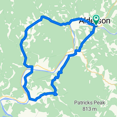
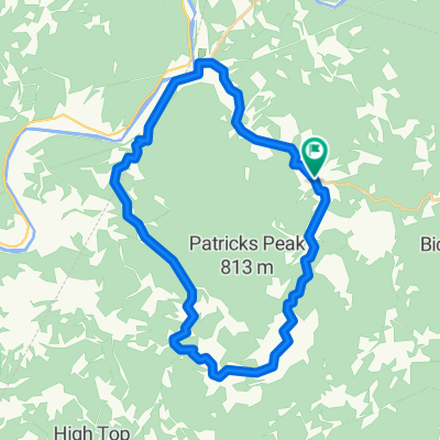
 Johnsons Crossroads Loop
- Distance
- 31.6 km
- Ascent
- 448 m
- Descent
- 449 m
- Location
- Alderson, West Virginia, United States
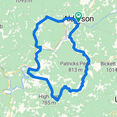
 Clayton Loop 1 CLONED FROM ROUTE 1520778
- Distance
- 34.8 km
- Ascent
- 480 m
- Descent
- 481 m
- Location
- Alderson, West Virginia, United States
 Muddy Creek Mtn. - Sinks Grove Loop
- Distance
- 49 km
- Ascent
- 724 m
- Descent
- 727 m
- Location
- Alderson, West Virginia, United States
 Alderson, Sinks Grove, Pence Springs Clayton Loop
- Distance
- 71 km
- Ascent
- 985 m
- Descent
- 988 m
- Location
- Alderson, West Virginia, United States
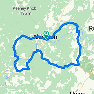
 Johnsons Crossroads - Clayton Combined
- Distance
- 56.2 km
- Ascent
- 667 m
- Descent
- 667 m
- Location
- Alderson, West Virginia, United States
 Johnsons Crossroads Loop
- Distance
- 31.7 km
- Ascent
- 1,824 m
- Descent
- 1,824 m
- Location
- Alderson, West Virginia, United States
 Lowell - Johnsons Crossroads Loop
- Distance
- 44.3 km
- Ascent
- 466 m
- Descent
- 466 m
- Location
- Alderson, West Virginia, United States
 Johnsons Crossroads - Clayton Combined Alternate
- Distance
- 50.1 km
- Ascent
- 618 m
- Descent
- 619 m
- Location
- Alderson, West Virginia, United States
Open it in the app