

Ragnola salita "Campanelli" discesa via Sicilia.
A cycling route starting in Centobuchi, The Marches, Italy.
Overview
About this route
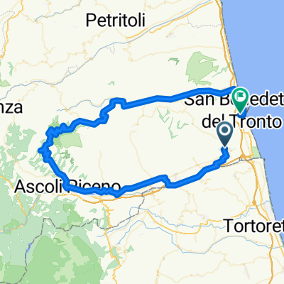
Typical training: a nice climb from the Ragnola area through fields, vineyards, and gravel climbs. The descent on Via Sicilia in the first section is full of potholes: caution, moderate your speed.
- -:--
- Duration
- 13.1 km
- Distance
- 295 m
- Ascent
- 296 m
- Descent
- ---
- Avg. speed
- ---
- Max. altitude

Continue with Bikemap
Use, edit, or download this cycling route
You would like to ride Ragnola salita "Campanelli" discesa via Sicilia. or customize it for your own trip? Here is what you can do with this Bikemap route:
Free features
- Save this route as favorite or in collections
- Copy & plan your own version of this route
- Sync your route with Garmin or Wahoo
Premium features
Free trial for 3 days, or one-time payment. More about Bikemap Premium.
- Navigate this route on iOS & Android
- Export a GPX / KML file of this route
- Create your custom printout (try it for free)
- Download this route for offline navigation
Discover more Premium features.
Get Bikemap PremiumFrom our community
Other popular routes starting in Centobuchi
 grottammare
- Distance
- 40.3 km
- Ascent
- 780 m
- Descent
- 780 m
- Location
- Centobuchi, The Marches, Italy
 Brancadoro
- Distance
- 25.2 km
- Ascent
- 805 m
- Descent
- 805 m
- Location
- Centobuchi, The Marches, Italy
 Centb.Cupra.Ripa.San S.Monteprandone
- Distance
- 45.6 km
- Ascent
- 652 m
- Descent
- 652 m
- Location
- Centobuchi, The Marches, Italy
 sbtascensionesbt
- Distance
- 92.8 km
- Ascent
- 1,501 m
- Descent
- 1,579 m
- Location
- Centobuchi, The Marches, Italy
 Escursione 27 marzo 2011
- Distance
- 67.2 km
- Ascent
- 947 m
- Descent
- 929 m
- Location
- Centobuchi, The Marches, Italy
 Giro Bello del Sabato Vittorio
- Distance
- 37.7 km
- Ascent
- 301 m
- Descent
- 302 m
- Location
- Centobuchi, The Marches, Italy
 02 aprile
- Distance
- 52.6 km
- Ascent
- 1,286 m
- Descent
- 1,286 m
- Location
- Centobuchi, The Marches, Italy
 Ragnola salita "Campanelli" discesa via Sicilia.
- Distance
- 13.1 km
- Ascent
- 295 m
- Descent
- 296 m
- Location
- Centobuchi, The Marches, Italy
Open it in the app