

Big Chin Loop
A cycling route starting in Brown Hill, Victoria, Australia.
Overview
About this route
Big Chin
- -:--
- Duration
- 27.2 km
- Distance
- 322 m
- Ascent
- 297 m
- Descent
- ---
- Avg. speed
- ---
- Max. altitude

Continue with Bikemap
Use, edit, or download this cycling route
You would like to ride Big Chin Loop or customize it for your own trip? Here is what you can do with this Bikemap route:
Free features
- Save this route as favorite or in collections
- Copy & plan your own version of this route
- Sync your route with Garmin or Wahoo
Premium features
Free trial for 3 days, or one-time payment. More about Bikemap Premium.
- Navigate this route on iOS & Android
- Export a GPX / KML file of this route
- Create your custom printout (try it for free)
- Download this route for offline navigation
Discover more Premium features.
Get Bikemap PremiumFrom our community
Other popular routes starting in Brown Hill
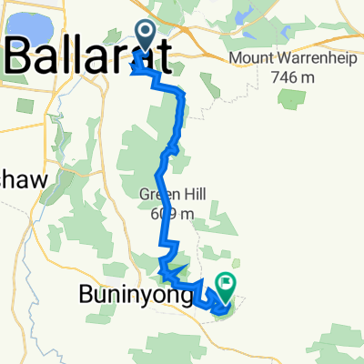 Ballarat to Buninyong
- Distance
- 19.1 km
- Ascent
- 581 m
- Descent
- 278 m
- Location
- Brown Hill, Victoria, Australia
 GF2 - Ballarat to Creswick
- Distance
- 21.8 km
- Ascent
- 270 m
- Descent
- 301 m
- Location
- Brown Hill, Victoria, Australia
 Lengthy bike tour through Daylesford
- Distance
- 67.4 km
- Ascent
- 592 m
- Descent
- 582 m
- Location
- Brown Hill, Victoria, Australia
 Creswick to Maryborough
- Distance
- 71 km
- Ascent
- 277 m
- Descent
- 477 m
- Location
- Brown Hill, Victoria, Australia
 Creswick to Maryborough
- Distance
- 56.7 km
- Ascent
- 302 m
- Descent
- 502 m
- Location
- Brown Hill, Victoria, Australia
 288 Humffray St N, Brown Hill to 500–512 Inglis St, Buninyong
- Distance
- 15.1 km
- Ascent
- 115 m
- Descent
- 129 m
- Location
- Brown Hill, Victoria, Australia
 Ballarat circuit
- Distance
- 52.3 km
- Ascent
- 493 m
- Descent
- 496 m
- Location
- Brown Hill, Victoria, Australia
 Creswick Gravel ride
- Distance
- 168.9 km
- Ascent
- 1,151 m
- Descent
- 1,152 m
- Location
- Brown Hill, Victoria, Australia
Open it in the app