

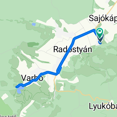
Lillafüred - Eger
A cycling route starting in Sajóbábony, Borsod-Abauj Zemplen county, Hungary.
Overview
About this route
Weg von Lillafüred durch den Bükk-Nationalpark nach Eger
- -:--
- Duration
- 47.3 km
- Distance
- 488 m
- Ascent
- 627 m
- Descent
- ---
- Avg. speed
- ---
- Max. altitude
Route quality
Waytypes & surfaces along the route
Waytypes
Busy road
39.7 km
(84 %)
Quiet road
4.8 km
(10 %)
Surfaces
Paved
27.1 km
(57 %)
Unpaved
0.1 km
(<1 %)
Asphalt
27 km
(57 %)
Wood
0.1 km
(<1 %)
Continue with Bikemap
Use, edit, or download this cycling route
You would like to ride Lillafüred - Eger or customize it for your own trip? Here is what you can do with this Bikemap route:
Free features
- Save this route as favorite or in collections
- Copy & plan your own version of this route
- Sync your route with Garmin or Wahoo
Premium features
Free trial for 3 days, or one-time payment. More about Bikemap Premium.
- Navigate this route on iOS & Android
- Export a GPX / KML file of this route
- Create your custom printout (try it for free)
- Download this route for offline navigation
Discover more Premium features.
Get Bikemap PremiumFrom our community
Other popular routes starting in Sajóbábony
 Pisztrángozós
- Distance
- 27.7 km
- Ascent
- 886 m
- Descent
- 889 m
- Location
- Sajóbábony, Borsod-Abauj Zemplen county, Hungary
 Erzsébet sétány 8, Miskolc to Egri Országút 3517, Miskolc
- Distance
- 34.4 km
- Ascent
- 1,572 m
- Descent
- 1,606 m
- Location
- Sajóbábony, Borsod-Abauj Zemplen county, Hungary
 Bükki teljesítménytúra - Autómentes nap 2015
- Distance
- 114.9 km
- Ascent
- 1,496 m
- Descent
- 1,497 m
- Location
- Sajóbábony, Borsod-Abauj Zemplen county, Hungary
 Hunyadi János utca, Sajólászlófalva - Rákóczi Ferenc utca, Sajólászlófalva
- Distance
- 14.9 km
- Ascent
- 85 m
- Descent
- 86 m
- Location
- Sajóbábony, Borsod-Abauj Zemplen county, Hungary
 Települések 2021.
- Distance
- 16.6 km
- Ascent
- 177 m
- Descent
- 406 m
- Location
- Sajóbábony, Borsod-Abauj Zemplen county, Hungary
 Bükk teljesítménytúra 50km
- Distance
- 47.5 km
- Ascent
- 671 m
- Descent
- 672 m
- Location
- Sajóbábony, Borsod-Abauj Zemplen county, Hungary
 Lillafüred - Eger
- Distance
- 47.3 km
- Ascent
- 488 m
- Descent
- 627 m
- Location
- Sajóbábony, Borsod-Abauj Zemplen county, Hungary
 Lillafüred kiskör
- Distance
- 15.9 km
- Ascent
- 528 m
- Descent
- 543 m
- Location
- Sajóbábony, Borsod-Abauj Zemplen county, Hungary
Open it in the app