

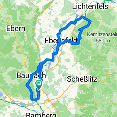
Der Neubaustrecke folgend
A cycling route starting in Kemmern, Bavaria, Germany.
Overview
About this route
The tour goes flat through the Itzgruntal to the Froschgrundsee near Coburg. From there, it passes through the Thuringian Forest, passing the Itz spring and Werra spring towards Goldisthal. There, you can visit the dam or the information center for the ICE line. This route is more suitable for road bikes than for mountain bikes. Mostly on smaller roads.
- -:--
- Duration
- 154.8 km
- Distance
- 1,296 m
- Ascent
- 1,239 m
- Descent
- ---
- Avg. speed
- ---
- Max. altitude
Route quality
Waytypes & surfaces along the route
Waytypes
Track
21.7 km
(14 %)
Path
21.7 km
(14 %)
Surfaces
Paved
85.1 km
(55 %)
Unpaved
12.4 km
(8 %)
Asphalt
83.6 km
(54 %)
Unpaved (undefined)
3.1 km
(2 %)
Continue with Bikemap
Use, edit, or download this cycling route
You would like to ride Der Neubaustrecke folgend or customize it for your own trip? Here is what you can do with this Bikemap route:
Free features
- Save this route as favorite or in collections
- Copy & plan your own version of this route
- Split it into stages to create a multi-day tour
- Sync your route with Garmin or Wahoo
Premium features
Free trial for 3 days, or one-time payment. More about Bikemap Premium.
- Navigate this route on iOS & Android
- Export a GPX / KML file of this route
- Create your custom printout (try it for free)
- Download this route for offline navigation
Discover more Premium features.
Get Bikemap PremiumFrom our community
Other popular routes starting in Kemmern
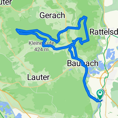 Von Kemmern über den Kraiberg zum Veitenstein
- Distance
- 39.4 km
- Ascent
- 429 m
- Descent
- 431 m
- Location
- Kemmern, Bavaria, Germany
 Kemmern-Feste Kronack
- Distance
- 64.5 km
- Ascent
- 307 m
- Descent
- 163 m
- Location
- Kemmern, Bavaria, Germany
 Haßberge
- Distance
- 40.3 km
- Ascent
- 119 m
- Descent
- 119 m
- Location
- Kemmern, Bavaria, Germany
 Kemmerner Keller - Hallstadt
- Distance
- 11 km
- Ascent
- 215 m
- Descent
- 240 m
- Location
- Kemmern, Bavaria, Germany
 Hohengüßbacher Runde
- Distance
- 23.2 km
- Ascent
- 227 m
- Descent
- 228 m
- Location
- Kemmern, Bavaria, Germany
 Der Neubaustrecke folgend
- Distance
- 154.8 km
- Ascent
- 1,296 m
- Descent
- 1,239 m
- Location
- Kemmern, Bavaria, Germany
 Gundelsheimer Wald - Sassendorf-Baunach
- Distance
- 30.9 km
- Ascent
- 277 m
- Descent
- 280 m
- Location
- Kemmern, Bavaria, Germany
 Kemmern - Veitsberg - Staffelberg - Vierzehnheiligen und zurück
- Distance
- 77.7 km
- Ascent
- 604 m
- Descent
- 604 m
- Location
- Kemmern, Bavaria, Germany
Open it in the app