dsdfsd
- 9.5 km
- 105 m
- 182 m
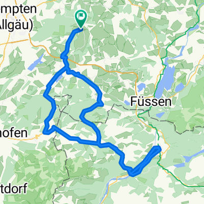
- Görisried, Bavaria, Germany
A cycling route starting in Görisried, Bavaria, Germany.
Overview
Görisried – Ellegg – Schnitztaleralpe – Königssträßchen – Bildstöckle – Oberjoch – Unterjoch – Wertach – Görisried
created this 12 years ago
Route quality
Quiet road
36.1 km
35 %
Road
22.7 km
22 %
Paved
85.6 km
(83 %)
Asphalt
74.3 km
72 %
Paved (undefined)
11.3 km
11 %
Undefined
17.5 km
17 %
Continue with Bikemap
You would like to ride Görisried – Grünten – Bildstöckle – Unterjoch – Görisried or customize it for your own trip? Here is what you can do with this Bikemap route:
Free trial for 3 days, or one-time payment. More about Bikemap Premium.
Discover more Premium features.
Get Bikemap PremiumFrom our community
Open it in the app