D_ "la aproximación ciclista a París sur"
A cycling route starting in Orléans, Centre-Val de Loire, France.
Overview
About this route
The Southern Approach to Paris is a free, independent, and unofficial route intended to go from Eurovelo 6 toward Paris, more specifically from Orléans to central Paris.
This route uses both local asphalted minor roads of fourth and third order and a couple of bike lanes from the greenways network.
The Approach prioritizes road safety and offers a very peaceful solution to reach central Paris from the suburbs.
Along the entire route, there are ample campgrounds and various types of accommodations.
From a cycling perspective, it is an easy and flat route with very few and occasional undulations.
This itinerary from Orléans to Paris favors the choice of lower-category roads. However, I advise you also to check the route using the OpenStreetMap option to seek alternatives that may please you more, especially around the Paris metropolitan area.
The main axis of the Approach is: Orléans – Étampes – Paris; to detail a bit more, these are the main towns and cities along this route: Orléans, Méréville, Étampes, Bretigny sur Orge, Longjumeau, Malakoff, and Paris.
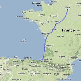
This axis is the last of the four that make up "the Atlantic cycling route to Paris: from Bidasoa to the Seine by bike," connecting the towns of Irun and Paris.
- info: [we are waiting to transfer all articles to another website since the official site domain has not been renewed. 05/2014]
- -:--
- Duration
- 135.9 km
- Distance
- 252 m
- Ascent
- 291 m
- Descent
- ---
- Avg. speed
- ---
- Max. altitude
Route quality
Waytypes & surfaces along the route
Waytypes
Road
44.9 km
(33 %)
Quiet road
32.6 km
(24 %)
Surfaces
Paved
62.5 km
(46 %)
Asphalt
59.8 km
(44 %)
Concrete
2.7 km
(2 %)
Undefined
73.4 km
(54 %)
Continue with Bikemap
Use, edit, or download this cycling route
You would like to ride D_ "la aproximación ciclista a París sur" or customize it for your own trip? Here is what you can do with this Bikemap route:
Free features
- Save this route as favorite or in collections
- Copy & plan your own version of this route
- Split it into stages to create a multi-day tour
- Sync your route with Garmin or Wahoo
Premium features
Free trial for 3 days, or one-time payment. More about Bikemap Premium.
- Navigate this route on iOS & Android
- Export a GPX / KML file of this route
- Create your custom printout (try it for free)
- Download this route for offline navigation
Discover more Premium features.
Get Bikemap PremiumFrom our community
Other popular routes starting in Orléans
 20200728 Day 12b - Orléans à Baule
- Distance
- 24.3 km
- Ascent
- 238 m
- Descent
- 244 m
- Location
- Orléans, Centre-Val de Loire, France
 La Vallée de la Loire
- Distance
- 260.3 km
- Ascent
- 1,033 m
- Descent
- 1,091 m
- Location
- Orléans, Centre-Val de Loire, France
 Tour de Loire, 2010
- Distance
- 443 km
- Ascent
- 251 m
- Descent
- 357 m
- Location
- Orléans, Centre-Val de Loire, France
 Orleans to Saumur in x days
- Distance
- 238.1 km
- Ascent
- 933 m
- Descent
- 987 m
- Location
- Orléans, Centre-Val de Loire, France
 Itinéraire à partir de Quai du Châtelet, Orléans
- Distance
- 9.7 km
- Ascent
- 139 m
- Descent
- 144 m
- Location
- Orléans, Centre-Val de Loire, France
 Quai St-Laurent, Orléans nach Le Châtelard, Chambord
- Distance
- 54.3 km
- Ascent
- 102 m
- Descent
- 123 m
- Location
- Orléans, Centre-Val de Loire, France
 Girolibero: Castelli della Loira Orleans Tours (6gg/5nt)
- Distance
- 244.8 km
- Ascent
- 282 m
- Descent
- 347 m
- Location
- Orléans, Centre-Val de Loire, France
 Road trip 2018
- Distance
- 5,912.9 km
- Ascent
- 2,924 m
- Descent
- 2,935 m
- Location
- Orléans, Centre-Val de Loire, France
Open it in the app


