

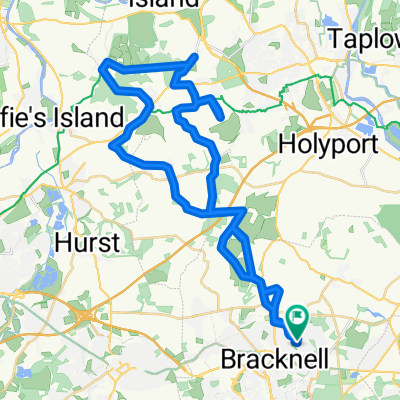
3 Counties Cycle Route (80 km)
A cycling route starting in Bracknell, England, United Kingdom.
Overview
About this route
The route is starting and ending in Bracknell via Twyford, Dunsden Green, Nettlebed, Remenham, an Henley-on-Thames.
- -:--
- Duration
- 82.5 km
- Distance
- 378 m
- Ascent
- 379 m
- Descent
- ---
- Avg. speed
- ---
- Max. altitude
Route quality
Waytypes & surfaces along the route
Waytypes
Road
23.1 km
(28 %)
Quiet road
15.7 km
(19 %)
Surfaces
Paved
37.1 km
(45 %)
Asphalt
37.1 km
(45 %)
Undefined
45.4 km
(55 %)
Continue with Bikemap
Use, edit, or download this cycling route
You would like to ride 3 Counties Cycle Route (80 km) or customize it for your own trip? Here is what you can do with this Bikemap route:
Free features
- Save this route as favorite or in collections
- Copy & plan your own version of this route
- Split it into stages to create a multi-day tour
- Sync your route with Garmin or Wahoo
Premium features
Free trial for 3 days, or one-time payment. More about Bikemap Premium.
- Navigate this route on iOS & Android
- Export a GPX / KML file of this route
- Create your custom printout (try it for free)
- Download this route for offline navigation
Discover more Premium features.
Get Bikemap PremiumFrom our community
Other popular routes starting in Bracknell
 Bracknell to crazies hill and know hill
- Distance
- 46 km
- Ascent
- 218 m
- Descent
- 218 m
- Location
- Bracknell, England, United Kingdom
 Short bike tour from 26/02/2016, 14:38
- Distance
- 8.8 km
- Ascent
- 57 m
- Descent
- 57 m
- Location
- Bracknell, England, United Kingdom
 Swinley Forest Blue Route
- Distance
- 8.5 km
- Ascent
- 50 m
- Descent
- 47 m
- Location
- Bracknell, England, United Kingdom
 Easy ride in Bracknell
- Distance
- 3.6 km
- Ascent
- 175 m
- Descent
- 168 m
- Location
- Bracknell, England, United Kingdom
 Swinley Forest
- Distance
- 19.8 km
- Ascent
- 203 m
- Descent
- 201 m
- Location
- Bracknell, England, United Kingdom
 Cycle Surgery Special
- Distance
- 26.9 km
- Ascent
- 131 m
- Descent
- 174 m
- Location
- Bracknell, England, United Kingdom
 crownwood loop
- Distance
- 7.2 km
- Ascent
- 34 m
- Descent
- 36 m
- Location
- Bracknell, England, United Kingdom
 BracknelltoNewburyandBack
- Distance
- 94.3 km
- Ascent
- 296 m
- Descent
- 296 m
- Location
- Bracknell, England, United Kingdom
Open it in the app