Dolomites - etapa 4
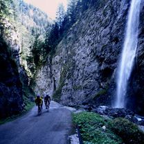
A cycling route starting in Rocca Pietore, Veneto, Italy.
Overview
About this route
allgue, araba, campolongo, gardena, sella, pordoi, marmolada.
- -:--
- Duration
- 98 km
- Distance
- 2,757 m
- Ascent
- 2,744 m
- Descent
- ---
- Avg. speed
- ---
- Avg. speed
Route quality
Waytypes & surfaces along the route
Waytypes
Busy road
94.5 km
(96 %)
Access road
1.1 km
(1 %)
Surfaces
Paved
90.2 km
(92 %)
Unpaved
0.7 km
(<1 %)
Asphalt
90.2 km
(92 %)
Gravel
0.5 km
(<1 %)
Route highlights
Points of interest along the route
Point of interest after 24.1 km
Passo Campolongo
Point of interest after 38.1 km
Passo Di Gardena per Passo Gardena, 5,5 km. 373ma 7% Per Canazei,11,4 km. 758 a 6,6% http://1001puertosdemontana.blogspot.com.es/2012/10/passo-sellasellajoch-por-canazei.html
Point of interest after 48.5 km
Passo Sella 5,5 km. 373 7% per passo Gardena
Point of interest after 60.7 km
Passo de Pordoi
Point of interest after 86 km
Passo Fedaia (Marmolada)
Continue with Bikemap
Use, edit, or download this cycling route
You would like to ride Dolomites - etapa 4 or customize it for your own trip? Here is what you can do with this Bikemap route:
Free features
- Save this route as favorite or in collections
- Copy & plan your own version of this route
- Sync your route with Garmin or Wahoo
Premium features
Free trial for 3 days, or one-time payment. More about Bikemap Premium.
- Navigate this route on iOS & Android
- Export a GPX / KML file of this route
- Create your custom printout (try it for free)
- Download this route for offline navigation
Discover more Premium features.
Get Bikemap PremiumFrom our community
Other popular routes starting in Rocca Pietore
- falzarego,campolongo,pordoi,fedaia
- Distance
- 98 km
- Ascent
- 2,876 m
- Descent
- 2,877 m
- Location
- Rocca Pietore, Veneto, Italy
- Dolomiti 3. dan
- Distance
- 89.1 km
- Ascent
- 1,999 m
- Descent
- 1,999 m
- Location
- Rocca Pietore, Veneto, Italy
- Giro d`Italia 2008 - stage 4
- Distance
- 85.5 km
- Ascent
- 3,088 m
- Descent
- 2,747 m
- Location
- Rocca Pietore, Veneto, Italy
- lidl-tour-2015-1-6
- Distance
- 87.9 km
- Ascent
- 1,462 m
- Descent
- 2,345 m
- Location
- Rocca Pietore, Veneto, Italy
- malga ciapela-forca rossa-val contrin-fedaia
- Distance
- 34.2 km
- Ascent
- 2,048 m
- Descent
- 2,046 m
- Location
- Rocca Pietore, Veneto, Italy
- lidl-tour-2015-1-5
- Distance
- 101.9 km
- Ascent
- 2,491 m
- Descent
- 2,484 m
- Location
- Rocca Pietore, Veneto, Italy
- Giro d`Italia 2009 - Stage 3
- Distance
- 88 km
- Ascent
- 2,323 m
- Descent
- 1,936 m
- Location
- Rocca Pietore, Veneto, Italy
- Caprile rifugio auronzo
- Distance
- 120.9 km
- Ascent
- 3,314 m
- Descent
- 3,314 m
- Location
- Rocca Pietore, Veneto, Italy