

Pankow-bernau-wandlitz-summt-Pankow
A cycling route starting in Heinersdorf, Land Berlin, Germany.
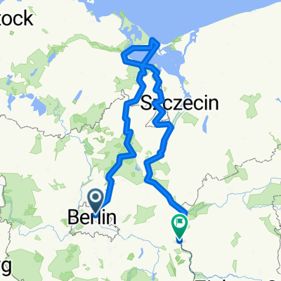
Overview
About this route
Bis Bernau Straße, dann Fahrradweg und einsame asphaltierte Waldwege bis Lipnitzsee, rest Landstraße
- -:--
- Duration
- 80.6 km
- Distance
- 216 m
- Ascent
- 216 m
- Descent
- ---
- Avg. speed
- 87 m
- Max. altitude
Route quality
Waytypes & surfaces along the route
Waytypes
Busy road
31.9 km
(40 %)
Path
11.3 km
(14 %)
Surfaces
Paved
69.1 km
(86 %)
Unpaved
7.9 km
(10 %)
Asphalt
56.1 km
(70 %)
Paving stones
11.2 km
(14 %)
Continue with Bikemap
Use, edit, or download this cycling route
You would like to ride Pankow-bernau-wandlitz-summt-Pankow or customize it for your own trip? Here is what you can do with this Bikemap route:
Free features
- Save this route as favorite or in collections
- Copy & plan your own version of this route
- Split it into stages to create a multi-day tour
- Sync your route with Garmin or Wahoo
Premium features
Free trial for 3 days, or one-time payment. More about Bikemap Premium.
- Navigate this route on iOS & Android
- Export a GPX / KML file of this route
- Create your custom printout (try it for free)
- Download this route for offline navigation
Discover more Premium features.
Get Bikemap PremiumFrom our community
Other popular routes starting in Heinersdorf
 Berlin-Usedom-FF/Oder-Neiße-Radfernwege
- Distance
- 536.4 km
- Ascent
- 809 m
- Descent
- 842 m
- Location
- Heinersdorf, Land Berlin, Germany
 Nostalgie-Tour nach Wandlitz
- Distance
- 72.6 km
- Ascent
- 116 m
- Descent
- 115 m
- Location
- Heinersdorf, Land Berlin, Germany
 Nostalgie-Tour nach Wandlitz
- Distance
- 72.6 km
- Ascent
- 106 m
- Descent
- 103 m
- Location
- Heinersdorf, Land Berlin, Germany
 Pankow Liebenwalde Pankow
- Distance
- 82.9 km
- Ascent
- 129 m
- Descent
- 131 m
- Location
- Heinersdorf, Land Berlin, Germany
 Berlin-Usedom-FF/Oder-Neiße-Radfernwege
- Distance
- 537.1 km
- Ascent
- 238 m
- Descent
- 257 m
- Location
- Heinersdorf, Land Berlin, Germany
 Wintertour auf dem Müggelsee
- Distance
- 53.1 km
- Ascent
- 51 m
- Descent
- 51 m
- Location
- Heinersdorf, Land Berlin, Germany
 Gustav-Adolf-Straße 27B nach Hubertusdamm
- Distance
- 10.5 km
- Ascent
- 17 m
- Descent
- 17 m
- Location
- Heinersdorf, Land Berlin, Germany
 Pankow Bernau Bad Freinwalde
- Distance
- 135.3 km
- Ascent
- 392 m
- Descent
- 374 m
- Location
- Heinersdorf, Land Berlin, Germany
Open it in the app