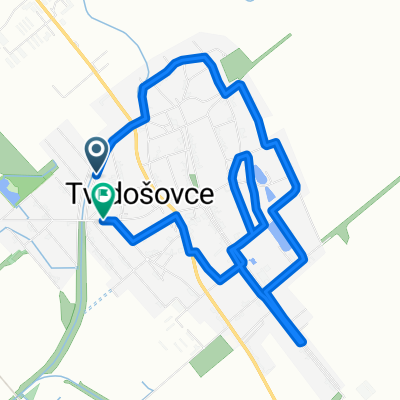
2013-08-17: Pozba (Podhájska) - Kováčová
A cycling route starting in Šurany, Nitra Region, Slovakia.
Overview
About this route
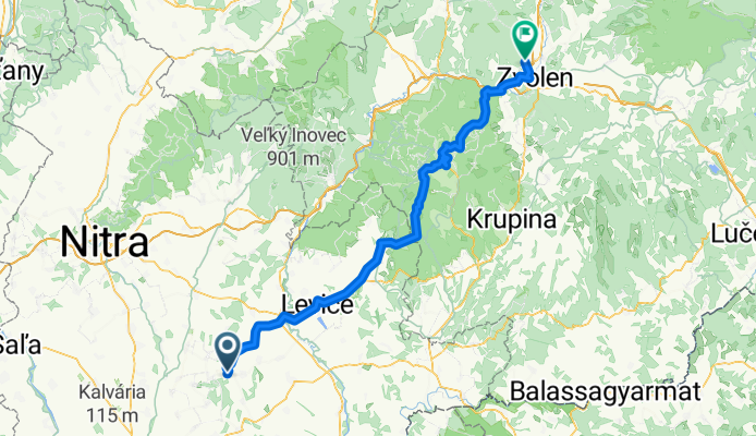
2013-08-17 (Saturday): Pozba (Podhájska) - Kováčová
Via Banská Štiavnica - -:--
- Duration
- 106.5 km
- Distance
- 858 m
- Ascent
- 699 m
- Descent
- ---
- Avg. speed
- ---
- Max. altitude
Route quality
Waytypes & surfaces along the route
Waytypes
Road
30.9 km
(29 %)
Quiet road
4.3 km
(4 %)
Surfaces
Paved
72.4 km
(68 %)
Asphalt
72.4 km
(68 %)
Undefined
34.1 km
(32 %)
Route highlights
Points of interest along the route
Point of interest after 60 km
Počúvadlianske Jazero, Banská Štiavnica, Slovakia
Continue with Bikemap
Use, edit, or download this cycling route
You would like to ride 2013-08-17: Pozba (Podhájska) - Kováčová or customize it for your own trip? Here is what you can do with this Bikemap route:
Free features
- Save this route as favorite or in collections
- Copy & plan your own version of this route
- Split it into stages to create a multi-day tour
- Sync your route with Garmin or Wahoo
Premium features
Free trial for 3 days, or one-time payment. More about Bikemap Premium.
- Navigate this route on iOS & Android
- Export a GPX / KML file of this route
- Create your custom printout (try it for free)
- Download this route for offline navigation
Discover more Premium features.
Get Bikemap PremiumFrom our community
Other popular routes starting in Šurany
- Velky okruh Lot
- Distance
- 36 km
- Ascent
- 140 m
- Descent
- 139 m
- Location
- Šurany, Nitra Region, Slovakia
- ride through Podhájska
- Distance
- 18.3 km
- Ascent
- 111 m
- Descent
- 109 m
- Location
- Šurany, Nitra Region, Slovakia
- Z08 Strekov
- Distance
- 79.2 km
- Ascent
- 311 m
- Descent
- 314 m
- Location
- Šurany, Nitra Region, Slovakia
- Šurany - Nitr.Hrádok - D.Ohaj - Vlkas - Úľany n. Žitavou
- Distance
- 22.7 km
- Ascent
- 37 m
- Descent
- 37 m
- Location
- Šurany, Nitra Region, Slovakia
- 2013-08-17: Pozba (Podhájska) - Kováčová
- Distance
- 106.5 km
- Ascent
- 858 m
- Descent
- 699 m
- Location
- Šurany, Nitra Region, Slovakia
- Easy ride in Veľký Kýr
- Distance
- 42.7 km
- Ascent
- 32 m
- Descent
- 28 m
- Location
- Šurany, Nitra Region, Slovakia
- Šurany - Úľany n. Žit. - Lúčnica n. Žit. - Žitavce - Maňa - Vlkas
- Distance
- 40.6 km
- Ascent
- 58 m
- Descent
- 61 m
- Location
- Šurany, Nitra Region, Slovakia
- Ľahká jazda dovnútra
- Distance
- 48.9 km
- Ascent
- 91 m
- Descent
- 124 m
- Location
- Šurany, Nitra Region, Slovakia
Open it in the app