

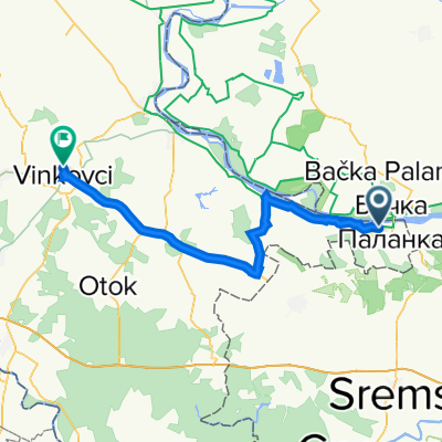
2013-09-26: Ilok - Novi Sad
A cycling route starting in Ilok, Vukovar-Srijem County, Croatia.
Overview
About this route
2013-09-26 (Thursday): Ilok - Novi Sad
- -:--
- Duration
- 52.7 km
- Distance
- 89 m
- Ascent
- 113 m
- Descent
- ---
- Avg. speed
- ---
- Max. altitude

Route quality
Waytypes & surfaces along the route
Waytypes
Busy road
33.4 km
(63 %)
Quiet road
6.4 km
(12 %)
Surfaces
Paved
42 km
(80 %)
Unpaved
0.1 km
(<1 %)
Asphalt
42 km
(80 %)
Unpaved (undefined)
0.1 km
(<1 %)
Continue with Bikemap
Use, edit, or download this cycling route
You would like to ride 2013-09-26: Ilok - Novi Sad or customize it for your own trip? Here is what you can do with this Bikemap route:
Free features
- Save this route as favorite or in collections
- Copy & plan your own version of this route
- Sync your route with Garmin or Wahoo
Premium features
Free trial for 3 days, or one-time payment. More about Bikemap Premium.
- Navigate this route on iOS & Android
- Export a GPX / KML file of this route
- Create your custom printout (try it for free)
- Download this route for offline navigation
Discover more Premium features.
Get Bikemap PremiumFrom our community
Other popular routes starting in Ilok
 Ilok-Opatovac-Tovarnik-Vinkovci
- Distance
- 63.8 km
- Ascent
- 256 m
- Descent
- 278 m
- Location
- Ilok, Vukovar-Srijem County, Croatia
 Ilok-Principovac-Vukovo-Ilok
- Distance
- 26.4 km
- Ascent
- 213 m
- Descent
- 213 m
- Location
- Ilok, Vukovar-Srijem County, Croatia
 HardCro ruta I
- Distance
- 1,481.7 km
- Ascent
- 3,541 m
- Descent
- 3,642 m
- Location
- Ilok, Vukovar-Srijem County, Croatia
 Tappa 7 - Ilok - Blegrado
- Distance
- 122.4 km
- Ascent
- 382 m
- Descent
- 391 m
- Location
- Ilok, Vukovar-Srijem County, Croatia
 1-Balkanroute-3
- Distance
- 251.2 km
- Ascent
- 1,336 m
- Descent
- 959 m
- Location
- Ilok, Vukovar-Srijem County, Croatia
 Ilok naar Paks
- Distance
- 224.1 km
- Ascent
- 457 m
- Descent
- 465 m
- Location
- Ilok, Vukovar-Srijem County, Croatia
 Ilok - Vukovar - Vinkovci
- Distance
- 54.1 km
- Ascent
- 136 m
- Descent
- 163 m
- Location
- Ilok, Vukovar-Srijem County, Croatia
 Etappe A Illok-Tovarnik
- Distance
- 29.5 km
- Ascent
- 140 m
- Descent
- 178 m
- Location
- Ilok, Vukovar-Srijem County, Croatia
Open it in the app