

Bald-Pk-Gaston-Yamhill-Loop
A cycling route starting in Cornelius, Oregon, United States.
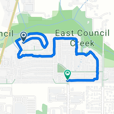
Overview
About this route
exported via maps.google
23.1 miles
- -:--
- Duration
- 37.2 km
- Distance
- 478 m
- Ascent
- 412 m
- Descent
- ---
- Avg. speed
- ---
- Max. altitude
Route quality
Waytypes & surfaces along the route
Waytypes
Cycleway
10.1 km
(27 %)
Road
6.7 km
(18 %)
Surfaces
Paved
21.2 km
(57 %)
Asphalt
21.2 km
(57 %)
Undefined
16 km
(43 %)
Continue with Bikemap
Use, edit, or download this cycling route
You would like to ride Bald-Pk-Gaston-Yamhill-Loop or customize it for your own trip? Here is what you can do with this Bikemap route:
Free features
- Save this route as favorite or in collections
- Copy & plan your own version of this route
- Sync your route with Garmin or Wahoo
Premium features
Free trial for 3 days, or one-time payment. More about Bikemap Premium.
- Navigate this route on iOS & Android
- Export a GPX / KML file of this route
- Create your custom printout (try it for free)
- Download this route for offline navigation
Discover more Premium features.
Get Bikemap PremiumFrom our community
Other popular routes starting in Cornelius
 1599 S Cherry St, Cornelius to 1589 S Cherry St, Cornelius
- Distance
- 32.7 km
- Ascent
- 120 m
- Descent
- 123 m
- Location
- Cornelius, Oregon, United States
 3505 Pacific Ave, Forest Grove to 3505 Pacific Ave, Forest Grove
- Distance
- 44.4 km
- Ascent
- 455 m
- Descent
- 457 m
- Location
- Cornelius, Oregon, United States
 N Irvine St, Cornelius to N 25th Ave, Cornelius
- Distance
- 2.7 km
- Ascent
- 10 m
- Descent
- 7 m
- Location
- Cornelius, Oregon, United States
 McCormick Hill
- Distance
- 65.5 km
- Ascent
- 1,295 m
- Descent
- 1,276 m
- Location
- Cornelius, Oregon, United States
 Three Capes W Detour Rev 3
- Distance
- 299.3 km
- Ascent
- 936 m
- Descent
- 935 m
- Location
- Cornelius, Oregon, United States
 Ride from home to Bald Peak State Park
- Distance
- 43.9 km
- Ascent
- 1,100 m
- Descent
- 1,223 m
- Location
- Cornelius, Oregon, United States
 Unger's Farm Store Route
- Distance
- 23.5 km
- Ascent
- 236 m
- Descent
- 232 m
- Location
- Cornelius, Oregon, United States
 1563 S Cherry St, Cornelius to 1589 S Cherry St, Cornelius
- Distance
- 32.6 km
- Ascent
- 170 m
- Descent
- 170 m
- Location
- Cornelius, Oregon, United States
Open it in the app