

Mendelpass - Gampelpass
A cycling route starting in San Paolo, Trentino-Alto Adige, Italy.
Overview
About this route
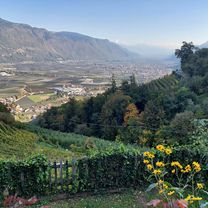
from St. Pauls over the Mendel and Gampel pass
- -:--
- Duration
- 70 km
- Distance
- 1,679 m
- Ascent
- 1,679 m
- Descent
- ---
- Avg. speed
- ---
- Max. altitude

Route quality
Waytypes & surfaces along the route
Waytypes
Road
7.7 km
(11 %)
Quiet road
5.6 km
(8 %)
Surfaces
Paved
63 km
(90 %)
Asphalt
63 km
(90 %)
Undefined
7 km
(10 %)
Continue with Bikemap
Use, edit, or download this cycling route
You would like to ride Mendelpass - Gampelpass or customize it for your own trip? Here is what you can do with this Bikemap route:
Free features
- Save this route as favorite or in collections
- Copy & plan your own version of this route
- Sync your route with Garmin or Wahoo
Premium features
Free trial for 3 days, or one-time payment. More about Bikemap Premium.
- Navigate this route on iOS & Android
- Export a GPX / KML file of this route
- Create your custom printout (try it for free)
- Download this route for offline navigation
Discover more Premium features.
Get Bikemap PremiumFrom our community
Other popular routes starting in San Paolo
 St. Paul - Auer - Bozen - St. Paul
- Distance
- 49.6 km
- Ascent
- 351 m
- Descent
- 351 m
- Location
- San Paolo, Trentino-Alto Adige, Italy
 Waldschenke in Altenburg
- Distance
- 14.8 km
- Ascent
- 419 m
- Descent
- 53 m
- Location
- San Paolo, Trentino-Alto Adige, Italy
 eppan - bozen
- Distance
- 26.6 km
- Ascent
- 725 m
- Descent
- 727 m
- Location
- San Paolo, Trentino-Alto Adige, Italy
 Giro de Rafenstein
- Distance
- 27.4 km
- Ascent
- 795 m
- Descent
- 796 m
- Location
- San Paolo, Trentino-Alto Adige, Italy
 Missianer Weg nach Missianer Weg
- Distance
- 76.3 km
- Ascent
- 810 m
- Descent
- 867 m
- Location
- San Paolo, Trentino-Alto Adige, Italy
 Mendelpass - Gampelpass
- Distance
- 70 km
- Ascent
- 1,679 m
- Descent
- 1,679 m
- Location
- San Paolo, Trentino-Alto Adige, Italy
 St. Paul - Mendelpass - St. Paul
- Distance
- 32.3 km
- Ascent
- 1,212 m
- Descent
- 1,212 m
- Location
- San Paolo, Trentino-Alto Adige, Italy
 Montiggler Waldrunde
- Distance
- 20.6 km
- Ascent
- 367 m
- Descent
- 368 m
- Location
- San Paolo, Trentino-Alto Adige, Italy
Open it in the app