

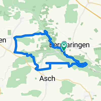
Südalb: Bermaringen-Mochental
A cycling route starting in Berghülen, Baden-Wurttemberg, Germany.
Overview
About this route
Beautiful route - aside from the detour over Blaubeuren - I would have probably done better to go through Seißen and the Long Valley to come directly to Weiler.
- -:--
- Duration
- 50.2 km
- Distance
- 611 m
- Ascent
- 698 m
- Descent
- ---
- Avg. speed
- ---
- Max. altitude

Continue with Bikemap
Use, edit, or download this cycling route
You would like to ride Südalb: Bermaringen-Mochental or customize it for your own trip? Here is what you can do with this Bikemap route:
Free features
- Save this route as favorite or in collections
- Copy & plan your own version of this route
- Sync your route with Garmin or Wahoo
Premium features
Free trial for 3 days, or one-time payment. More about Bikemap Premium.
- Navigate this route on iOS & Android
- Export a GPX / KML file of this route
- Create your custom printout (try it for free)
- Download this route for offline navigation
Discover more Premium features.
Get Bikemap PremiumFrom our community
Other popular routes starting in Berghülen
 Berghülen - Lämmerbuckel
- Distance
- 16.6 km
- Ascent
- 272 m
- Descent
- 158 m
- Location
- Berghülen, Baden-Wurttemberg, Germany
 Sonntags Runde
- Distance
- 18 km
- Ascent
- 273 m
- Descent
- 273 m
- Location
- Berghülen, Baden-Wurttemberg, Germany
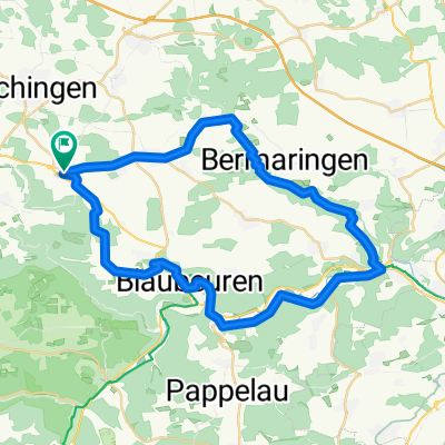
 Bermaringen-Blaubeuren-Günzelburg-Sonderbuch-Ulm
- Distance
- 50 km
- Ascent
- 424 m
- Descent
- 594 m
- Location
- Berghülen, Baden-Wurttemberg, Germany
 Kleines Lautertal
- Distance
- 43.8 km
- Ascent
- 342 m
- Descent
- 343 m
- Location
- Berghülen, Baden-Wurttemberg, Germany
 Lautertal-Runde
- Distance
- 37.4 km
- Ascent
- 461 m
- Descent
- 461 m
- Location
- Berghülen, Baden-Wurttemberg, Germany
 Bermaringen-Blaustein-Ulm-Dettingen-Bernstadt_Bermaringen
- Distance
- 100.8 km
- Ascent
- 431 m
- Descent
- 434 m
- Location
- Berghülen, Baden-Wurttemberg, Germany
 Halbschatten Tour
- Distance
- 17.2 km
- Ascent
- 212 m
- Descent
- 211 m
- Location
- Berghülen, Baden-Wurttemberg, Germany
 Lautertal-Runde
- Distance
- 37.3 km
- Ascent
- 472 m
- Descent
- 472 m
- Location
- Berghülen, Baden-Wurttemberg, Germany
Open it in the app