

Bozcaada-Canakkale-Guzelyurt
A cycling route starting in Geyikli, Çanakkale Province, Republic of Türkiye.
Overview
About this route
Kumkale-Osmanli Mezarligi with intermittent stone slab sections. Dirt road between Osmanli Mezarligi and Yenikoy.
- -:--
- Duration
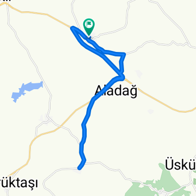
- 78.7 km
- Distance
- 407 m
- Ascent
- 405 m
- Descent
- ---
- Avg. speed
- ---
- Max. altitude

Route quality
Waytypes & surfaces along the route
Waytypes
Road
32.3 km
(41 %)
Cycleway
19.7 km
(25 %)
Surfaces
Paved
23.6 km
(30 %)
Asphalt
23.6 km
(30 %)
Undefined
55.1 km
(70 %)
Continue with Bikemap
Use, edit, or download this cycling route
You would like to ride Bozcaada-Canakkale-Guzelyurt or customize it for your own trip? Here is what you can do with this Bikemap route:
Free features
- Save this route as favorite or in collections
- Copy & plan your own version of this route
- Sync your route with Garmin or Wahoo
Premium features
Free trial for 3 days, or one-time payment. More about Bikemap Premium.
- Navigate this route on iOS & Android
- Export a GPX / KML file of this route
- Create your custom printout (try it for free)
- Download this route for offline navigation
Discover more Premium features.
Get Bikemap PremiumFrom our community
Other popular routes starting in Geyikli
 TR A7 Dalyan-Saltik
- Distance
- 80.7 km
- Ascent
- 569 m
- Descent
- 584 m
- Location
- Geyikli, Çanakkale Province, Republic of Türkiye
 geyikli - assos- ayvacık
- Distance
- 92.7 km
- Ascent
- 1,033 m
- Descent
- 762 m
- Location
- Geyikli, Çanakkale Province, Republic of Türkiye
 Bozcaada-Canakkale-Guzelyurt
- Distance
- 78.7 km
- Ascent
- 407 m
- Descent
- 405 m
- Location
- Geyikli, Çanakkale Province, Republic of Türkiye
 От Fatih Han Caddesi 2, Dalyan до Kemal Yeri Sokak 34
- Distance
- 56.2 km
- Ascent
- 888 m
- Descent
- 887 m
- Location
- Geyikli, Çanakkale Province, Republic of Türkiye
 Q7Q3+QX, Gökçebayır to Gökçebayır Köyü Yolu
- Distance
- 16.3 km
- Ascent
- 100 m
- Descent
- 142 m
- Location
- Geyikli, Çanakkale Province, Republic of Türkiye
 geyikli-canakkale merk.
- Distance
- 58.2 km
- Ascent
- 1,026 m
- Descent
- 1,022 m
- Location
- Geyikli, Çanakkale Province, Republic of Türkiye
 Alemsah - Ayvacık 80km
- Distance
- 79.2 km
- Ascent
- 1,092 m
- Descent
- 1,081 m
- Location
- Geyikli, Çanakkale Province, Republic of Türkiye
 Alemşah - Kumburun 105 km
- Distance
- 105.3 km
- Ascent
- 1,200 m
- Descent
- 1,194 m
- Location
- Geyikli, Çanakkale Province, Republic of Türkiye
Open it in the app