

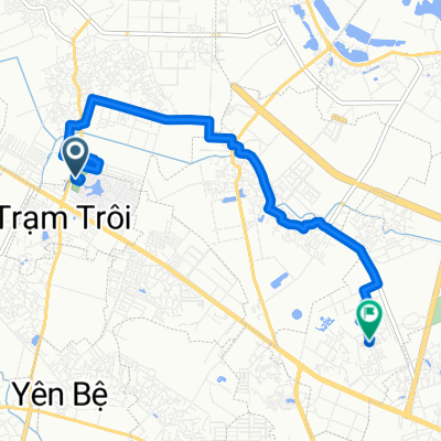
タンロン橋
A cycling route starting in Trôi, Hanoi, Vietnam.
Overview
About this route
タンロン橋
- -:--
- Duration
- 12.3 km
- Distance
- 51 m
- Ascent
- 51 m
- Descent
- ---
- Avg. speed
- ---
- Max. altitude
Continue with Bikemap
Use, edit, or download this cycling route
You would like to ride タンロン橋 or customize it for your own trip? Here is what you can do with this Bikemap route:
Free features
- Save this route as favorite or in collections
- Copy & plan your own version of this route
- Sync your route with Garmin or Wahoo
Premium features
Free trial for 3 days, or one-time payment. More about Bikemap Premium.
- Navigate this route on iOS & Android
- Export a GPX / KML file of this route
- Create your custom printout (try it for free)
- Download this route for offline navigation
Discover more Premium features.
Get Bikemap PremiumFrom our community
Other popular routes starting in Trôi
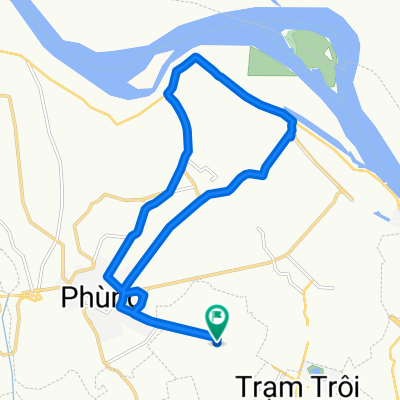
 Unnamed Road to Hoài Đức
- Distance
- 18.7 km
- Ascent
- 76 m
- Descent
- 49 m
- Location
- Trôi, Hanoi, Vietnam
 Đường Thượng Cát 280 to Đường Hồ Tùng Mậu Ngõ 136
- Distance
- 11.3 km
- Ascent
- 16 m
- Descent
- 18 m
- Location
- Trôi, Hanoi, Vietnam
 Hoài Đức to Hoài Đức
- Distance
- 14.7 km
- Ascent
- 62 m
- Descent
- 65 m
- Location
- Trôi, Hanoi, Vietnam
 Quốc lộ 32 89 to Hoài Đức
- Distance
- 17.2 km
- Ascent
- 113 m
- Descent
- 86 m
- Location
- Trôi, Hanoi, Vietnam
 Hoài Đức to Hoài Đức
- Distance
- 14.7 km
- Ascent
- 49 m
- Descent
- 60 m
- Location
- Trôi, Hanoi, Vietnam
 đến nhà tình iu
- Distance
- 84 km
- Ascent
- 62 m
- Descent
- 70 m
- Location
- Trôi, Hanoi, Vietnam
 Di hoc
- Distance
- 8.5 km
- Ascent
- 10 m
- Descent
- 10 m
- Location
- Trôi, Hanoi, Vietnam
 Hoài Đức to Hoài Đức
- Distance
- 21.1 km
- Ascent
- 64 m
- Descent
- 69 m
- Location
- Trôi, Hanoi, Vietnam
Open it in the app