


Michaelskreuz (801m): Cham - Zug - Arth - Fänn - Michaelskreuz - Root - Sins - Cham (55.8Km, 510hm)
- 55.8 km
- 492 m
- 492 m
- Sins, Canton of Aargau, Switzerland
A cycling route starting in Sins, Canton of Aargau, Switzerland.
Overview
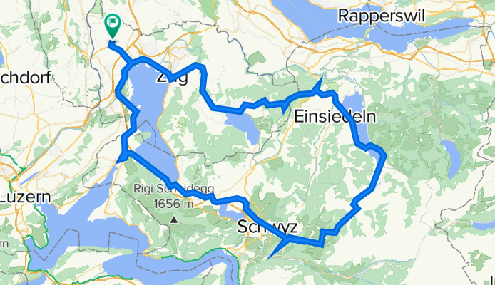
Cham - Oberägeri - Raten (1077m) - Einsiedeln - Ibergeregg (1406m) - Schwyz - Holzhäusern - Cham
created this 12 years ago
Route quality
Road
20.4 km
(19 %)
Quiet road
3.2 km
(3 %)
Paved
60.2 km
(56 %)
Asphalt
60.2 km
(56 %)
Undefined
47.3 km
(44 %)
Continue with Bikemap
You would like to ride Ibergeregg (1406m): Cham - Oberägeri - Raten (1077m) - Einsiedeln - Ibergeregg (1406m) - Schwyz - Holzhäusern - Cham (108Km, 1450hm) or customize it for your own trip? Here is what you can do with this Bikemap route:
Free trial for 3 days, or one-time payment. More about Bikemap Premium.
Discover more Premium features.
Get Bikemap PremiumFrom our community
Open it in the app


