

Ruota-M Serra
A cycling route starting in Orentano, Tuscany, Italy.
Overview
About this route
alternative track from Ruota, longer...
- -:--
- Duration
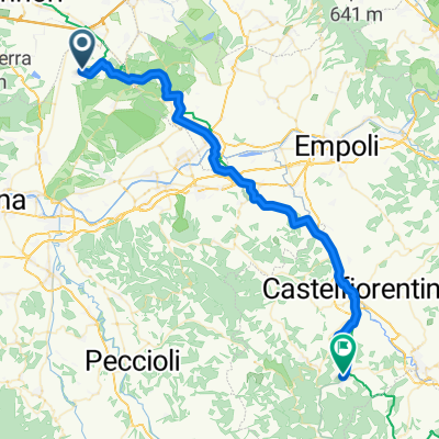
- 8.1 km
- Distance
- 588 m
- Ascent
- 103 m
- Descent
- ---
- Avg. speed
- ---
- Max. altitude
Route quality
Waytypes & surfaces along the route
Waytypes
Quiet road
5.1 km
(63 %)
Track
2.2 km
(27 %)
Undefined
0.8 km
(10 %)
Surfaces
Paved
0.1 km
(1 %)
Unpaved
2.8 km
(35 %)
Ground
2.8 km
(35 %)
Asphalt
0.1 km
(1 %)
Undefined
5.2 km
(64 %)
Continue with Bikemap
Use, edit, or download this cycling route
You would like to ride Ruota-M Serra or customize it for your own trip? Here is what you can do with this Bikemap route:
Free features
- Save this route as favorite or in collections
- Copy & plan your own version of this route
- Sync your route with Garmin or Wahoo
Premium features
Free trial for 3 days, or one-time payment. More about Bikemap Premium.
- Navigate this route on iOS & Android
- Export a GPX / KML file of this route
- Create your custom printout (try it for free)
- Download this route for offline navigation
Discover more Premium features.
Get Bikemap PremiumFrom our community
Other popular routes starting in Orentano
 alternative track
- Distance
- 27 km
- Ascent
- 1,070 m
- Descent
- 1,070 m
- Location
- Orentano, Tuscany, Italy
 Base to Gambassi
- Distance
- 50.5 km
- Ascent
- 763 m
- Descent
- 472 m
- Location
- Orentano, Tuscany, Italy
 Ruota-M Serra
- Distance
- 8.1 km
- Ascent
- 588 m
- Descent
- 103 m
- Location
- Orentano, Tuscany, Italy
 c\vecchio-s.jacopo-piavole-cvecchio
- Distance
- 28.5 km
- Ascent
- 828 m
- Descent
- 861 m
- Location
- Orentano, Tuscany, Italy
 Castelvecchio - Ruota - Castelvecchio
- Distance
- 11.8 km
- Ascent
- 919 m
- Descent
- 236 m
- Location
- Orentano, Tuscany, Italy
 20111023-LaGamballaria
- Distance
- 82.3 km
- Ascent
- 903 m
- Descent
- 903 m
- Location
- Orentano, Tuscany, Italy
 Da Via Tullio Cristiani 153, Castelfranco di Sotto a Via Tullio Cristiani 153, Castelfranco di Sotto
- Distance
- 24.7 km
- Ascent
- 200 m
- Descent
- 202 m
- Location
- Orentano, Tuscany, Italy
 PADULE - GIRO DEL LAGHETTO
- Distance
- 3.1 km
- Ascent
- 12 m
- Descent
- 13 m
- Location
- Orentano, Tuscany, Italy
Open it in the app