

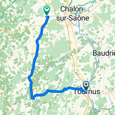
Tournus - Mâcon Hotel Park Inn
A cycling route starting in Tournus, Bourgogne-Franche-Comté, France.
Overview
About this route
Alternate route for the unexpected
- -:--
- Duration
- 30.7 km
- Distance
- 26 m
- Ascent
- 28 m
- Descent
- ---
- Avg. speed
- ---
- Max. altitude
Route quality
Waytypes & surfaces along the route
Waytypes
Path
19.7 km
(64 %)
Quiet road
7.4 km
(24 %)
Surfaces
Paved
8 km
(26 %)
Unpaved
15.4 km
(50 %)
Loose gravel
13.5 km
(44 %)
Asphalt
8 km
(26 %)
Continue with Bikemap
Use, edit, or download this cycling route
You would like to ride Tournus - Mâcon Hotel Park Inn or customize it for your own trip? Here is what you can do with this Bikemap route:
Free features
- Save this route as favorite or in collections
- Copy & plan your own version of this route
- Sync your route with Garmin or Wahoo
Premium features
Free trial for 3 days, or one-time payment. More about Bikemap Premium.
- Navigate this route on iOS & Android
- Export a GPX / KML file of this route
- Create your custom printout (try it for free)
- Download this route for offline navigation
Discover more Premium features.
Get Bikemap PremiumFrom our community
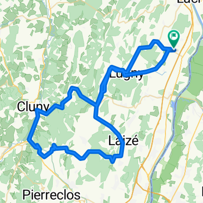
Other popular routes starting in Tournus
 Tournus-Cormatin-Givry
- Distance
- 50.1 km
- Ascent
- 497 m
- Descent
- 457 m
- Location
- Tournus, Bourgogne-Franche-Comté, France
 Tournus - Régnié-Durette
- Distance
- 65.3 km
- Ascent
- 197 m
- Descent
- 47 m
- Location
- Tournus, Bourgogne-Franche-Comté, France
 • Maconnnais Tournus-Tournus mit Auto last vers
- Distance
- 41.2 km
- Ascent
- 319 m
- Descent
- 321 m
- Location
- Tournus, Bourgogne-Franche-Comté, France
 Tour de France 2016 dzień 20
- Distance
- 141 km
- Ascent
- 801 m
- Descent
- 469 m
- Location
- Tournus, Bourgogne-Franche-Comté, France
 Tournus - Mâcon Hotel Park Inn
- Distance
- 30.7 km
- Ascent
- 26 m
- Descent
- 28 m
- Location
- Tournus, Bourgogne-Franche-Comté, France
 Truchère-Chagny
- Distance
- 61.8 km
- Ascent
- 201 m
- Descent
- 154 m
- Location
- Tournus, Bourgogne-Franche-Comté, France
 Uchizy clunisois A/R
- Distance
- 75.6 km
- Ascent
- 708 m
- Descent
- 706 m
- Location
- Tournus, Bourgogne-Franche-Comté, France
 Saône--La Truchère-Chalon sur Saône-Champforgeuil
- Distance
- 42.3 km
- Ascent
- 34 m
- Descent
- 21 m
- Location
- Tournus, Bourgogne-Franche-Comté, France
Open it in the app