

Buchanan
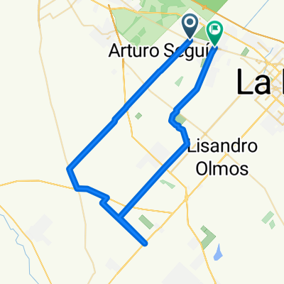
A cycling route starting in La Plata, Buenos Aires, Argentina.
Overview
About this route
Buchanan es una vieja estacion abandonada. no te la pierdas
- -:--
- Duration
- 52.8 km
- Distance
- 71 m
- Ascent
- 71 m
- Descent
- ---
- Avg. speed
- ---
- Max. altitude

Route highlights
Points of interest along the route
Point of interest after 3.9 km
Les Recomiendo buscar calle Alternativa como la 20
Point of interest after 5 km
Point of interest after 7.1 km
hasta calle 426
Point of interest after 7.4 km
Seguir las indicaciones a ESTANCIA EL RINCON
Point of interest after 10.5 km
Estancia El RINCON
Point of interest after 12.7 km
Seguir el camino
Point of interest after 16 km
RP36
Point of interest after 19.3 km
Autovia 2, Barrio el Peligro, no hay problema pasa derecho
Point of interest after 20.9 km
Seguir el camino
Point of interest after 25.2 km
Cruzar la via y doblar a la Derecha. por las via o el camino
Point of interest after 26.6 km
Estacion BUCHANAN
Point of interest after 28.4 km
Seguir el camino
Point of interest after 32.8 km
Autodromo
Point of interest after 42.1 km
doblar en la calle 178
Point of interest after 43.7 km
Doblar en calle 11, asfaltada
Point of interest after 45.1 km
doblar en la calle 160
Point of interest after 47.1 km
Cruzar el arroyo, por un precario puente o por el agua
Point of interest after 47.7 km
calle 501
Point of interest after 48.4 km
Frigorina
Continue with Bikemap
Use, edit, or download this cycling route
You would like to ride Buchanan or customize it for your own trip? Here is what you can do with this Bikemap route:
Free features
- Save this route as favorite or in collections
- Copy & plan your own version of this route
- Sync your route with Garmin or Wahoo
Premium features
Free trial for 3 days, or one-time payment. More about Bikemap Premium.
- Navigate this route on iOS & Android
- Export a GPX / KML file of this route
- Create your custom printout (try it for free)
- Download this route for offline navigation
Discover more Premium features.
Get Bikemap PremiumFrom our community
Other popular routes starting in La Plata
 Villa Elisa - Pipinas
- Distance
- 120.7 km
- Ascent
- 85 m
- Descent
- 92 m
- Location
- La Plata, Buenos Aires, Argentina
 Pereyra Rodri 2/11
- Distance
- 12.2 km
- Ascent
- 357 m
- Descent
- 356 m
- Location
- La Plata, Buenos Aires, Argentina
 Buchanan
- Distance
- 52.8 km
- Ascent
- 71 m
- Descent
- 71 m
- Location
- La Plata, Buenos Aires, Argentina
 La Plata - Oliden - Correas
- Distance
- 80.6 km
- Ascent
- 31 m
- Descent
- 27 m
- Location
- La Plata, Buenos Aires, Argentina
 La Plata - Bahía Blanca - 2012
- Distance
- 672.2 km
- Ascent
- 510 m
- Descent
- 471 m
- Location
- La Plata, Buenos Aires, Argentina
 Vuelta grande
- Distance
- 94 km
- Ascent
- 103 m
- Descent
- 105 m
- Location
- La Plata, Buenos Aires, Argentina
 Villa Elisa - Gomez - City Bell
- Distance
- 62.9 km
- Ascent
- 48 m
- Descent
- 41 m
- Location
- La Plata, Buenos Aires, Argentina
 parque eco
- Distance
- 10.1 km
- Ascent
- 188 m
- Descent
- 181 m
- Location
- La Plata, Buenos Aires, Argentina
Open it in the app