
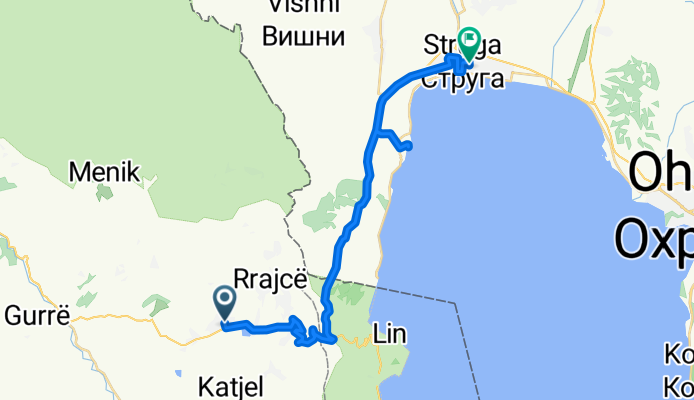
Përrenjas - Struga (Macedònia) / 14-11-2013
A cycling route starting in Përrenjas, Qarku i Elbasanit, Albania.
Overview
About this route
<span style="color: rgb(0, 0, 0); font-family: sans-serif; line-height: 19px;">Përrenjas - Struga (Macedònia) / 14-11-2013</span>
- -:--
- Duration
- 30.1 km
- Distance
- 551 m
- Ascent
- 436 m
- Descent
- ---
- Avg. speed
- ---
- Max. altitude
Route quality
Waytypes & surfaces along the route
Waytypes
Busy road
17.8 km
(59 %)
Road
8.5 km
(28 %)
Surfaces
Paved
19.7 km
(65 %)
Asphalt
19.4 km
(64 %)
Paving stones
0.3 km
(1 %)
Undefined
10.4 km
(35 %)
Continue with Bikemap
Use, edit, or download this cycling route
You would like to ride Përrenjas - Struga (Macedònia) / 14-11-2013 or customize it for your own trip? Here is what you can do with this Bikemap route:
Free features
- Save this route as favorite or in collections
- Copy & plan your own version of this route
- Sync your route with Garmin or Wahoo
Premium features
Free trial for 3 days, or one-time payment. More about Bikemap Premium.
- Navigate this route on iOS & Android
- Export a GPX / KML file of this route
- Create your custom printout (try it for free)
- Download this route for offline navigation
Discover more Premium features.
Get Bikemap PremiumFrom our community
Other popular routes starting in Përrenjas
 Përrenjas - Struga (Macedònia) / 14-11-2013
- Distance
- 30.1 km
- Ascent
- 551 m
- Descent
- 436 m
- Location
- Përrenjas, Qarku i Elbasanit, Albania
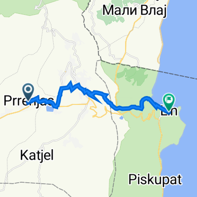
 2015-03500 Benefistanbul-Perrenjas-Bilisht
- Distance
- 81.5 km
- Ascent
- 895 m
- Descent
- 584 m
- Location
- Përrenjas, Qarku i Elbasanit, Albania
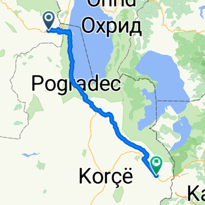
 De 3GCX+J93, Prrenjas a SH87, Lin
- Distance
- 11.3 km
- Ascent
- 465 m
- Descent
- 343 m
- Location
- Përrenjas, Qarku i Elbasanit, Albania
Open it in the app