

Verlängerung Echternach
A cycling route starting in Echternacherbrück, Rhineland-Palatinate, Germany.
Overview
About this route
Echternach - Berdorf, knackiger Anstieg nach ca. 3 km von etwa 150 m auf etwas über 300 m
- -:--
- Duration
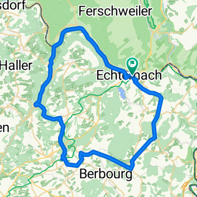
- 5.7 km
- Distance
- 232 m
- Ascent
- 27 m
- Descent
- ---
- Avg. speed
- ---
- Max. altitude
Route quality
Waytypes & surfaces along the route
Waytypes
Quiet road
0.3 km
(6 %)
Cycleway
0.3 km
(5 %)
Surfaces
Paved
5.6 km
(98 %)
Asphalt
5.5 km
(97 %)
Paved (undefined)
0.1 km
(1 %)
Undefined
0.1 km
(2 %)
Continue with Bikemap
Use, edit, or download this cycling route
You would like to ride Verlängerung Echternach or customize it for your own trip? Here is what you can do with this Bikemap route:
Free features
- Save this route as favorite or in collections
- Copy & plan your own version of this route
- Sync your route with Garmin or Wahoo
Premium features
Free trial for 3 days, or one-time payment. More about Bikemap Premium.
- Navigate this route on iOS & Android
- Export a GPX / KML file of this route
- Create your custom printout (try it for free)
- Download this route for offline navigation
Discover more Premium features.
Get Bikemap PremiumFrom our community
Other popular routes starting in Echternacherbrück
 Relaxed route in Echternach
- Distance
- 28.1 km
- Ascent
- 173 m
- Descent
- 230 m
- Location
- Echternacherbrück, Rhineland-Palatinate, Germany
 Echternach - Herborn - Consdorf - Müllerthal
- Distance
- 41.9 km
- Ascent
- 623 m
- Descent
- 614 m
- Location
- Echternacherbrück, Rhineland-Palatinate, Germany
 MTB - Echternach - E-See - Berdorf - Hohley
- Distance
- 18.2 km
- Ascent
- 310 m
- Descent
- 309 m
- Location
- Echternacherbrück, Rhineland-Palatinate, Germany
 Charly_Gaul_100k_2015
- Distance
- 99 km
- Ascent
- 917 m
- Descent
- 937 m
- Location
- Echternacherbrück, Rhineland-Palatinate, Germany
 Die 4 Hügel
- Distance
- 51.6 km
- Ascent
- 831 m
- Descent
- 829 m
- Location
- Echternacherbrück, Rhineland-Palatinate, Germany
 Echternach - Prümzurlay - Ferschweiler - Weilerbach
- Distance
- 23 km
- Ascent
- 276 m
- Descent
- 276 m
- Location
- Echternacherbrück, Rhineland-Palatinate, Germany
 3Ländereck E4b Echternach-Wasserbillig
- Distance
- 27.7 km
- Ascent
- 106 m
- Descent
- 133 m
- Location
- Echternacherbrück, Rhineland-Palatinate, Germany
 Rundtour in Luxemburg
- Distance
- 56.7 km
- Ascent
- 469 m
- Descent
- 457 m
- Location
- Echternacherbrück, Rhineland-Palatinate, Germany
Open it in the app