

R-iT
A cycling route starting in Moosbrunn, Lower Austria, Austria.
Overview
About this route
schneller Weg zur R-IT 25 KM ~ 1:09 H
- -:--
- Duration
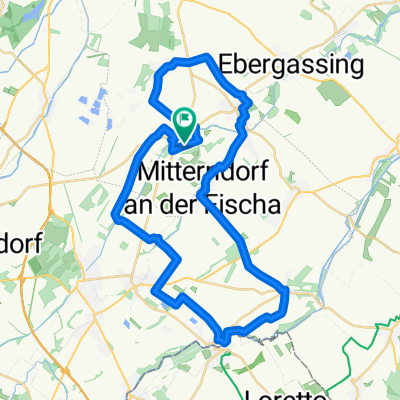
- 24.9 km
- Distance
- 76 m
- Ascent
- 74 m
- Descent
- ---
- Avg. speed
- ---
- Max. altitude
Route quality
Waytypes & surfaces along the route
Waytypes
Track
8.4 km
(34 %)
Cycleway
5.9 km
(24 %)
Surfaces
Paved
13.6 km
(55 %)
Unpaved
7.7 km
(31 %)
Asphalt
11.7 km
(47 %)
Loose gravel
6 km
(24 %)
Continue with Bikemap
Use, edit, or download this cycling route
You would like to ride R-iT or customize it for your own trip? Here is what you can do with this Bikemap route:
Free features
- Save this route as favorite or in collections
- Copy & plan your own version of this route
- Sync your route with Garmin or Wahoo
Premium features
Free trial for 3 days, or one-time payment. More about Bikemap Premium.
- Navigate this route on iOS & Android
- Export a GPX / KML file of this route
- Create your custom printout (try it for free)
- Download this route for offline navigation
Discover more Premium features.
Get Bikemap PremiumFrom our community
Other popular routes starting in Moosbrunn
 R-iT
R-iT- Distance
- 24.9 km
- Ascent
- 76 m
- Descent
- 74 m
- Location
- Moosbrunn, Lower Austria, Austria
 Ausblick auf die Fischa – Radbrücke über die Leitha Runde von Moosbrunn. 🚴♂️🚴.
- Distance
- 25.8 km
- Ascent
- 192 m
- Descent
- 100 m
- Location
- Moosbrunn, Lower Austria, Austria
 Parkteich Schwechat – Mannswörth Runde von Moosbrunn. 🚴♂️🚴
- Distance
- 51.5 km
- Ascent
- 242 m
- Descent
- 244 m
- Location
- Moosbrunn, Lower Austria, Austria
 Wienerherberg Runde
- Distance
- 29.9 km
- Ascent
- 52 m
- Descent
- 52 m
- Location
- Moosbrunn, Lower Austria, Austria
 Moosbrunn - Burgenland -Moosbrunn
- Distance
- 69.3 km
- Ascent
- 444 m
- Descent
- 441 m
- Location
- Moosbrunn, Lower Austria, Austria
 Feldweg Moosbrunn -Ma. Lanzendorf
- Distance
- 11.9 km
- Ascent
- 6 m
- Descent
- 22 m
- Location
- Moosbrunn, Lower Austria, Austria
 Neubachgasse, Moosbrunn nach Neubachgasse, Moosbrunn
- Distance
- 41.2 km
- Ascent
- 77 m
- Descent
- 77 m
- Location
- Moosbrunn, Lower Austria, Austria
 Schloss Trautmannsdorf – Cafe Winter Runde von Moosbrunn. 🚴♂️🚴
- Distance
- 59.6 km
- Ascent
- 124 m
- Descent
- 125 m
- Location
- Moosbrunn, Lower Austria, Austria
Open it in the app