

Jochpass via Vals Anratter Hütte Südtirol
A cycling route starting in Mühlbach, Trentino-Alto Adige, Italy.
Overview
About this route
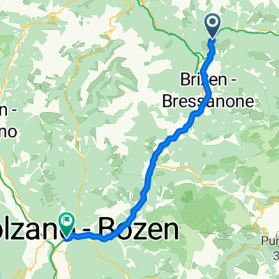
Route to the Joch Pass
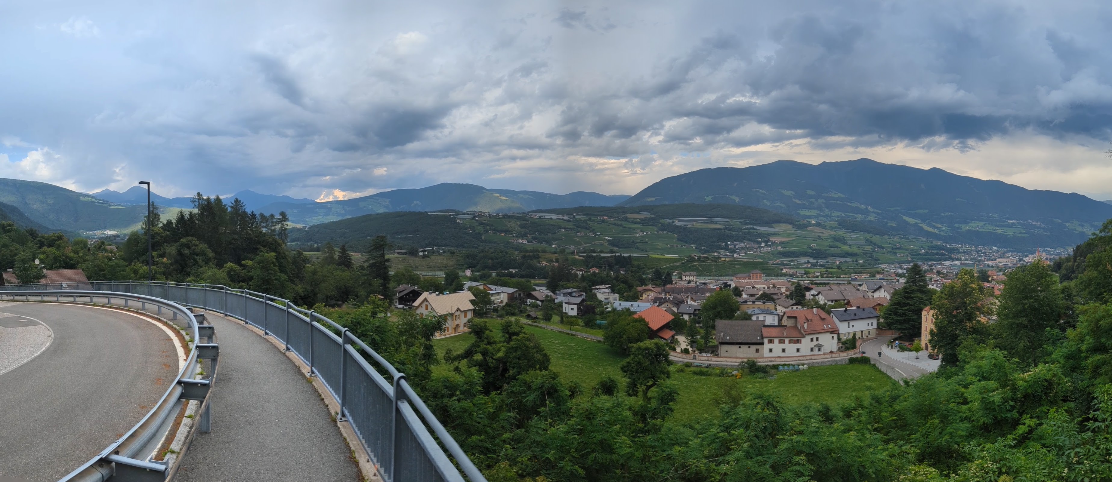
Autumn holidays with the family at Kinderhotel Huber. In Mühlbach, I rent a bike and enjoy the sun despite the cold wind. For the first time, I ride a 29er bike and immediately feel comfortable. Through Masl, I follow the forest road that stretches quite a bit until I reach the Anratter hut. I did not expect so much snow; luckily, there were tracks. I follow these until I reach the top at the Joch Pass near the mountain station.
Bitterly cold, I still enjoy the view and want to descend via the ski slope. However, the lift staff advises against it, so I have to go down the same way I came up. I take a short break at the Anratter hut before rapidly descending to Masl and then riding around the village. Great tour that should not be underestimated.
Ride time 2:15:50 Distance 21.62 km Average speed 9.55 km/h Fastest 50.06 km/h Ascent 1123 meters Descent 1135 meters Bike Bergamont 29er rental bike GPS Cyclemeter Notes Ascent Jochtal 1.28h
- -:--
- Duration
- 21.6 km
- Distance
- 902 m
- Ascent
- 901 m
- Descent
- ---
- Avg. speed
- ---
- Max. altitude

Continue with Bikemap
Use, edit, or download this cycling route
You would like to ride Jochpass via Vals Anratter Hütte Südtirol or customize it for your own trip? Here is what you can do with this Bikemap route:
Free features
- Save this route as favorite or in collections
- Copy & plan your own version of this route
- Sync your route with Garmin or Wahoo
Premium features
Free trial for 3 days, or one-time payment. More about Bikemap Premium.
- Navigate this route on iOS & Android
- Export a GPX / KML file of this route
- Create your custom printout (try it for free)
- Download this route for offline navigation
Discover more Premium features.
Get Bikemap PremiumFrom our community
Other popular routes starting in Mühlbach
 Dolomiten Tag 1
- Distance
- 93.1 km
- Ascent
- 1,657 m
- Descent
- 867 m
- Location
- Mühlbach, Trentino-Alto Adige, Italy
 Stöcklvaterweg nach Via Scaleres
- Distance
- 15.7 km
- Ascent
- 350 m
- Descent
- 505 m
- Location
- Mühlbach, Trentino-Alto Adige, Italy
 Spinges - Stoanamandl - Panoramaweg
- Distance
- 17 km
- Ascent
- 804 m
- Descent
- 799 m
- Location
- Mühlbach, Trentino-Alto Adige, Italy
 Mühlbach - Bozen
- Distance
- 54.1 km
- Ascent
- 766 m
- Descent
- 1,276 m
- Location
- Mühlbach, Trentino-Alto Adige, Italy
 Leitensteig. NICHT fürs MTB!!
- Distance
- 5.3 km
- Ascent
- 134 m
- Descent
- 232 m
- Location
- Mühlbach, Trentino-Alto Adige, Italy
 Jochpass via Vals Anratter Hütte Südtirol
- Distance
- 21.6 km
- Ascent
- 902 m
- Descent
- 901 m
- Location
- Mühlbach, Trentino-Alto Adige, Italy
 Tratterhof, Meransen
- Distance
- 0.2 km
- Ascent
- 12 m
- Descent
- 8 m
- Location
- Mühlbach, Trentino-Alto Adige, Italy
 Val Pusteria 7) Rio Pusteria- Rasun di Sopra
- Distance
- 40.7 km
- Ascent
- 1,018 m
- Descent
- 706 m
- Location
- Mühlbach, Trentino-Alto Adige, Italy
Open it in the app