

Caumont
A cycling route starting in Condé-sur-Vire, Normandy, France.
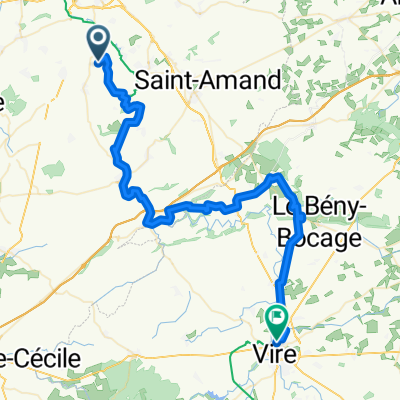
Overview
About this route
st martin des besaces cahagnes caumont
- -:--
- Duration
- 50.5 km
- Distance
- 493 m
- Ascent
- 496 m
- Descent
- ---
- Avg. speed
- ---
- Max. altitude
Route quality
Waytypes & surfaces along the route
Waytypes
Road
12.6 km
(25 %)
Quiet road
7.1 km
(14 %)
Surfaces
Paved
14.6 km
(29 %)
Unpaved
1.5 km
(3 %)
Asphalt
14.6 km
(29 %)
Unpaved (undefined)
0.5 km
(1 %)
Continue with Bikemap
Use, edit, or download this cycling route
You would like to ride Caumont or customize it for your own trip? Here is what you can do with this Bikemap route:
Free features
- Save this route as favorite or in collections
- Copy & plan your own version of this route
- Sync your route with Garmin or Wahoo
Premium features
Free trial for 3 days, or one-time payment. More about Bikemap Premium.
- Navigate this route on iOS & Android
- Export a GPX / KML file of this route
- Create your custom printout (try it for free)
- Download this route for offline navigation
Discover more Premium features.
Get Bikemap PremiumFrom our community
Other popular routes starting in Condé-sur-Vire
 De 12 La Roque Plate, Le Mesnil-Raoult à 12 La Roque Plate, Le Mesnil-Raoult
- Distance
- 37.1 km
- Ascent
- 374 m
- Descent
- 370 m
- Location
- Condé-sur-Vire, Normandy, France
 Itinéraire vers 12 La Roque Plate, Le Mesnil-Raoult
- Distance
- 7.3 km
- Ascent
- 105 m
- Descent
- 32 m
- Location
- Condé-sur-Vire, Normandy, France
 Condé-sur-Vire - Vire
- Distance
- 55.5 km
- Ascent
- 791 m
- Descent
- 739 m
- Location
- Condé-sur-Vire, Normandy, France
 Itinéraire modéré en Troisgots
- Distance
- 32.4 km
- Ascent
- 21 m
- Descent
- 138 m
- Location
- Condé-sur-Vire, Normandy, France
 Easy ride in
- Distance
- 3.8 km
- Ascent
- 3 m
- Descent
- 0 m
- Location
- Condé-sur-Vire, Normandy, France
 LA MEAUFFE
- Distance
- 21.7 km
- Ascent
- 261 m
- Descent
- 301 m
- Location
- Condé-sur-Vire, Normandy, France
 Conde sur Vire - Pont Farcy
- Distance
- 26.1 km
- Ascent
- 135 m
- Descent
- 157 m
- Location
- Condé-sur-Vire, Normandy, France
 Recovered Route
- Distance
- 10.3 km
- Ascent
- 89 m
- Descent
- 19 m
- Location
- Condé-sur-Vire, Normandy, France
Open it in the app