

Mancuso e Revenino
A cycling route starting in Gizzeria, Calabria, Italy.
Overview
About this route
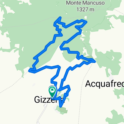
DOUBLE LOOP OF THE MANCUSO AND REVENTINO MOUNTAINS
- -:--
- Duration
- 73.2 km
- Distance
- 2,138 m
- Ascent
- 2,138 m
- Descent
- ---
- Avg. speed
- ---
- Max. altitude
Continue with Bikemap
Use, edit, or download this cycling route
You would like to ride Mancuso e Revenino or customize it for your own trip? Here is what you can do with this Bikemap route:
Free features
- Save this route as favorite or in collections
- Copy & plan your own version of this route
- Sync your route with Garmin or Wahoo
Premium features
Free trial for 3 days, or one-time payment. More about Bikemap Premium.
- Navigate this route on iOS & Android
- Export a GPX / KML file of this route
- Create your custom printout (try it for free)
- Download this route for offline navigation
Discover more Premium features.
Get Bikemap PremiumFrom our community
Other popular routes starting in Gizzeria
 Mancuso e Revenino
- Distance
- 73.2 km
- Ascent
- 2,138 m
- Descent
- 2,138 m
- Location
- Gizzeria, Calabria, Italy
 Doppio Anello del Monte Greco
- Distance
- 24.5 km
- Ascent
- 996 m
- Descent
- 996 m
- Location
- Gizzeria, Calabria, Italy
 percorso XC-AM grande giro gizzeria monte mancuso
- Distance
- 31.9 km
- Ascent
- 1,051 m
- Descent
- 1,051 m
- Location
- Gizzeria, Calabria, Italy
 Marathon Mancuso
- Distance
- 40.5 km
- Ascent
- 1,402 m
- Descent
- 1,402 m
- Location
- Gizzeria, Calabria, Italy
 anello gizzeria monte mancuso
- Distance
- 22.5 km
- Ascent
- 837 m
- Descent
- 853 m
- Location
- Gizzeria, Calabria, Italy
 raduno agosto 2013
- Distance
- 31.6 km
- Ascent
- 1,108 m
- Descent
- 1,108 m
- Location
- Gizzeria, Calabria, Italy
 VILLAGGIO PALUMBO
- Distance
- 172.4 km
- Ascent
- 2,366 m
- Descent
- 2,366 m
- Location
- Gizzeria, Calabria, Italy
 Giro dei Monti MancusoReventino e Tiriolo
- Distance
- 97.9 km
- Ascent
- 2,659 m
- Descent
- 2,659 m
- Location
- Gizzeria, Calabria, Italy
Open it in the app