Auf den Spuren des Rochlitzer Porphyrs - Ostroute - in Bearbeitung
A cycling route starting in Seelitz, Saxony, Germany.
Overview
About this route
am 16.01.14 zusammen mit Gotthard eingetragen
- -:--
- Duration
- 51.2 km
- Distance
- 370 m
- Ascent
- 370 m
- Descent
- ---
- Avg. speed
- ---
- Avg. speed
Route quality
Waytypes & surfaces along the route
Waytypes
Quiet road
26.7 km
(52 %)
Road
11.7 km
(23 %)
Surfaces
Paved
31.9 km
(62 %)
Unpaved
3 km
(6 %)
Asphalt
25 km
(49 %)
Paved (undefined)
4 km
(8 %)
Route highlights
Points of interest along the route
Point of interest after 4.2 km
Kirche Frankenau
Point of interest after 6.8 km
Postmeilensäule Erlau
Point of interest after 7.3 km
Kirche Erlau
Point of interest after 9.8 km
Kirche Crossen
Point of interest after 9.8 km
Gemeindeamt Crossen
Point of interest after 13.5 km
Kirche Tanneberg
Point of interest after 15.3 km
Kirche Beerwalde
Point of interest after 17.5 km
Alte Mühle Schweikershain
Point of interest after 18.2 km
Kirche Schweikershain
Point of interest after 24.2 km
Postmeilensäule Geringswalde
Point of interest after 24.3 km
Kirche Geringswalde
Point of interest after 24.4 km
Rathaus Geringswalde
Point of interest after 27.1 km
Kirche Hermsdorf
Point of interest after 27.5 km
Geburtshaus Orgelbaumeister Ladegast
Point of interest after 30.5 km
Alte Schule Zettlitz
Point of interest after 30.6 km
Kirche Zettlitz
Point of interest after 38 km
Regenbogenschule Rochlitz
Point of interest after 38.1 km
Gymnasium Rochlitz
Point of interest after 38.3 km
Porphyrbaum Markt Rochlitz
Point of interest after 38.4 km
Rathaus Rochlitz
Point of interest after 38.6 km
Brunnen Töpfermarkt Rochlitz
Point of interest after 38.8 km
St. Kunigundenkirche Rochlitz
Point of interest after 38.9 km
Brunnen
Point of interest after 38.9 km
Postmeilensäule Clemens-Pfau-Platz Rochlitz
Point of interest after 40 km
Postmeilensäule Burgstraße Rochlitz
Point of interest after 40.2 km
St. Petrikirche Rochlitz
Point of interest after 40.3 km
Schloss Rochlitz
Point of interest after 43.4 km
St. Annenkirche Seelitz
Point of interest after 50.3 km
Erlbachbrücke ("Saubrücke")
Continue with Bikemap
Use, edit, or download this cycling route
You would like to ride Auf den Spuren des Rochlitzer Porphyrs - Ostroute - in Bearbeitung or customize it for your own trip? Here is what you can do with this Bikemap route:
Free features
- Save this route as favorite or in collections
- Copy & plan your own version of this route
- Sync your route with Garmin or Wahoo
Premium features
Free trial for 3 days, or one-time payment. More about Bikemap Premium.
- Navigate this route on iOS & Android
- Export a GPX / KML file of this route
- Create your custom printout (try it for free)
- Download this route for offline navigation
Discover more Premium features.
Get Bikemap PremiumFrom our community
Other popular routes starting in Seelitz
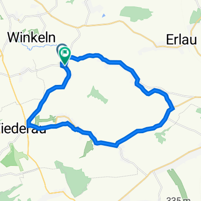
- Hauptstraße 24B, Königshain-Wiederau nach Hauptstraße 24B, Königshain-Wiederau
- Distance
- 21 km
- Ascent
- 204 m
- Descent
- 213 m
- Location
- Seelitz, Saxony, Germany
- 4 - Auf den Spuren des Roten Porphyrs zwischen Rochlitz und der Talsperre Kriebstein
- Distance
- 63.9 km
- Ascent
- 586 m
- Descent
- 586 m
- Location
- Seelitz, Saxony, Germany
- Seelitz Mister X
- Distance
- 6.3 km
- Ascent
- 149 m
- Descent
- 140 m
- Location
- Seelitz, Saxony, Germany
- D-B 20 a Seelitz - Eilenburg
- Distance
- 68.3 km
- Ascent
- 94 m
- Descent
- 193 m
- Location
- Seelitz, Saxony, Germany
- Weg zum Supermarkt in Rochlitz
- Distance
- 6.8 km
- Ascent
- 64 m
- Descent
- 154 m
- Location
- Seelitz, Saxony, Germany
- rochlitzer bergtriathlon Radstrecke
- Distance
- 32.7 km
- Ascent
- 380 m
- Descent
- 386 m
- Location
- Seelitz, Saxony, Germany
- Auf den Spuren des Rochlitzer Porphyrs - Ostroute - in Bearbeitung
- Distance
- 51.2 km
- Ascent
- 370 m
- Descent
- 370 m
- Location
- Seelitz, Saxony, Germany
- Rochlitz-Chemnitz MTB
- Distance
- 40.5 km
- Ascent
- 337 m
- Descent
- 172 m
- Location
- Seelitz, Saxony, Germany
Open it in the app