ツール・ド・堺
- 87.5 km
- 575 m
- 575 m
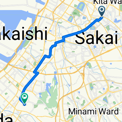
- Matsubara, Osaka, Japan
A cycling route starting in Matsubara, Osaka, Japan.
Overview
2813m Loop
12'40" @4'30"/km 14'04" @5'00"/km 15'30" @5'30"/km 16'53" @6'00"/kmRoute quality
Pedestrian area
2.8 km
(100 %)
Paved
2.8 km
(100 %)
Asphalt
2.8 km
(100 %)
Continue with Bikemap
You would like to ride Nagai Park 2813m or customize it for your own trip? Here is what you can do with this Bikemap route:
Free trial for 3 days, or one-time payment. More about Bikemap Premium.
Discover more Premium features.
Get Bikemap PremiumFrom our community
Open it in the app