

Völgy Vidék Maraton 2014
A cycling route starting in Vál, Fejér, Hungary.
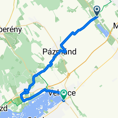
Overview
About this route
Gyúr, Tordas, Kajsz, Gyúr, Vál, Tabajd, Göböljárás puszta, Etyek, Gyúr
- -:--
- Duration
- 55.3 km
- Distance
- 478 m
- Ascent
- 478 m
- Descent
- ---
- Avg. speed
- ---
- Max. altitude
Route quality
Waytypes & surfaces along the route
Waytypes
Track
31 km
(56 %)
Quiet road
14.9 km
(27 %)
Surfaces
Paved
14.9 km
(27 %)
Unpaved
14.4 km
(26 %)
Asphalt
14.9 km
(27 %)
Ground
7.2 km
(13 %)
Continue with Bikemap
Use, edit, or download this cycling route
You would like to ride Völgy Vidék Maraton 2014 or customize it for your own trip? Here is what you can do with this Bikemap route:
Free features
- Save this route as favorite or in collections
- Copy & plan your own version of this route
- Sync your route with Garmin or Wahoo
Premium features
Free trial for 3 days, or one-time payment. More about Bikemap Premium.
- Navigate this route on iOS & Android
- Export a GPX / KML file of this route
- Create your custom printout (try it for free)
- Download this route for offline navigation
Discover more Premium features.
Get Bikemap PremiumFrom our community
Other popular routes starting in Vál
 Martonvásár hazafelé alternatív útvonal
- Distance
- 47.8 km
- Ascent
- 193 m
- Descent
- 261 m
- Location
- Vál, Fejér, Hungary
 nagy kör edzés
- Distance
- 31.3 km
- Ascent
- 286 m
- Descent
- 284 m
- Location
- Vál, Fejér, Hungary
 Völgyvidék MTB Maraton 2016 Középtáv
- Distance
- 60.7 km
- Ascent
- 487 m
- Descent
- 487 m
- Location
- Vál, Fejér, Hungary
 Völgyvidék MTB Maraton 2016
- Distance
- 131.9 km
- Ascent
- 805 m
- Descent
- 805 m
- Location
- Vál, Fejér, Hungary
 MTB Völgymaraton
- Distance
- 53.9 km
- Ascent
- 474 m
- Descent
- 474 m
- Location
- Vál, Fejér, Hungary
 Völgy Vidék Maraton 2014 - középtáv
- Distance
- 57.1 km
- Ascent
- 416 m
- Descent
- 416 m
- Location
- Vál, Fejér, Hungary
 Kajászó Faloda-Velence vasútállomás - 2025.07.14.
- Distance
- 26.1 km
- Ascent
- 236 m
- Descent
- 280 m
- Location
- Vál, Fejér, Hungary
 Gyúró-Komárom
- Distance
- 97.8 km
- Ascent
- 1,120 m
- Descent
- 1,128 m
- Location
- Vál, Fejér, Hungary
Open it in the app