Italia & Alpy part II
A cycling route starting in Sarnico, Lombardy, Italy.
Overview
About this route
Moja wyprawa rowerowa do Italii i w Alpy część 2
Z Sarnico do Katowic i pociągiem do Lublina.- -:--
- Duration
- 1,349.7 km
- Distance
- 7,059 m
- Ascent
- 6,983 m
- Descent
- ---
- Avg. speed
- ---
- Max. altitude
Route highlights
Points of interest along the route

Point of interest after 35.3 km
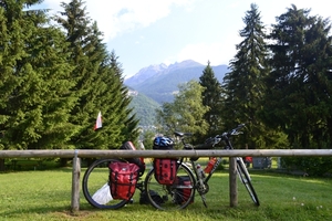
Biwak na dziko nad rzeką Oglio koło Darfo Boario Terme 4.07.2013

Point of interest after 101.4 km
Na cempingu "Presanella" w Temú - 10 € 5.07.2013

Point of interest after 123 km
Passo di Gávia (2652 m n.p.m.) Przejechałem 06.07.2013

Point of interest after 151.9 km
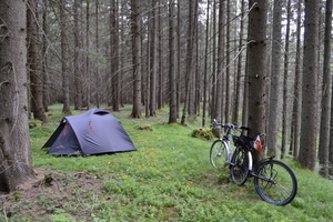
Biwak na dziko tuż za Bormio - 6.07.2013

Point of interest after 170.3 km
Passo dello Stelvio (2757 m n.p.m.) Przejechałem 07.07.2013

Point of interest after 173.5 km
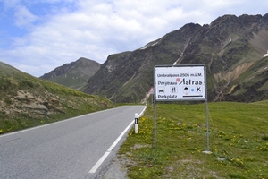
Umbrailpass (2503 m n.p.m.) Przejechałem 07.07.2013

Point of interest after 253.4 km
Biwak nad rzeką Adige przed Lagundo 7.07.2013

Point of interest after 331.1 km
Biwak na stoku za Selva Gardena Wolkenstein 8.07.2013

Point of interest after 344.7 km
Passo Gardena (2119 m n.p.m.) Przejechałem 09.07.2013

Point of interest after 402.9 km
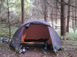
Biwak w lesie koło Untergasse 9.07.2013

Point of interest after 483.5 km
Mörtschach - camping Lindlerhof - 8 € 10.07.2013

Point of interest after 513.1 km
Przełęcz Hochtor (2504 m n.p.m.) Przejechałem 11.07.2013

Point of interest after 560.6 km
Biwak na dziko przy drodze 311 koło Lend 11.07.2013

Point of interest after 675.1 km
Biwak nad jeziorem Mondsee 12.07.2013

Point of interest after 844.7 km
Biwak w lesie nad Dunajem koło Teuch 13.07.2013

Point of interest after 996.8 km
Biwak na dziko koło Kleinsitzendorf - 14.07.2013

Point of interest after 1,132.7 km
Biwak za Ostrokovicami 15.07.2013

Point of interest after 1,268.8 km
Ostatni biwak już za Cieszynem koło Ogrodzona 16.07.2013
Continue with Bikemap
Use, edit, or download this cycling route
You would like to ride Italia & Alpy part II or customize it for your own trip? Here is what you can do with this Bikemap route:
Free features
- Save this route as favorite or in collections
- Copy & plan your own version of this route
- Split it into stages to create a multi-day tour
- Sync your route with Garmin or Wahoo
Premium features
Free trial for 3 days, or one-time payment. More about Bikemap Premium.
- Navigate this route on iOS & Android
- Export a GPX / KML file of this route
- Create your custom printout (try it for free)
- Download this route for offline navigation
Discover more Premium features.
Get Bikemap PremiumFrom our community
Other popular routes starting in Sarnico
 Sarnico - Bergamo (RITORNO)
- Distance
- 37.8 km
- Ascent
- 232 m
- Descent
- 172 m
- Location
- Sarnico, Lombardy, Italy
 Lago d'Iseo-Lago di Endine-Lago di Gaiano
- Distance
- 81.8 km
- Ascent
- 1,459 m
- Descent
- 1,461 m
- Location
- Sarnico, Lombardy, Italy
 . percorso strada del verde
- Distance
- 47.5 km
- Ascent
- 1,224 m
- Descent
- 1,225 m
- Location
- Sarnico, Lombardy, Italy
 Italia & Alpy part II
- Distance
- 1,349.7 km
- Ascent
- 7,059 m
- Descent
- 6,983 m
- Location
- Sarnico, Lombardy, Italy
 Sarnico-Grone.S.Fermo-Caf-Tavernola B.
- Distance
- 63.7 km
- Ascent
- 1,536 m
- Descent
- 1,537 m
- Location
- Sarnico, Lombardy, Italy
 Montisola
- Distance
- 42.1 km
- Ascent
- 483 m
- Descent
- 487 m
- Location
- Sarnico, Lombardy, Italy
 Sarnico-Urago d'Oglio
- Distance
- 54.5 km
- Ascent
- 259 m
- Descent
- 259 m
- Location
- Sarnico, Lombardy, Italy
 Sarnico Bossico
- Distance
- 76.6 km
- Ascent
- 1,101 m
- Descent
- 1,101 m
- Location
- Sarnico, Lombardy, Italy
Open it in the app


