

Alpillenrunde
A cycling route starting in Mouriès, Provence-Alpes-Côte d'Azur Region, France.
Overview
About this route
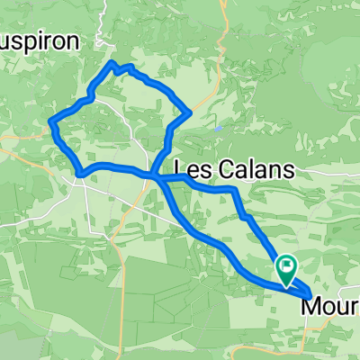
Mouries,Aureille,Les Baux, Saint Etienne du Gres, Maussanne zurück nach Mouries
- -:--
- Duration
- 63.3 km
- Distance
- 821 m
- Ascent
- 808 m
- Descent
- ---
- Avg. speed
- 251 m
- Max. altitude
Route quality
Waytypes & surfaces along the route
Waytypes
Road
32.2 km
(51 %)
Busy road
23.5 km
(37 %)
Surfaces
Paved
51.6 km
(82 %)
Unpaved
0.3 km
(<1 %)
Asphalt
51.2 km
(81 %)
Concrete
0.4 km
(<1 %)
Continue with Bikemap
Use, edit, or download this cycling route
You would like to ride Alpillenrunde or customize it for your own trip? Here is what you can do with this Bikemap route:
Free features
- Save this route as favorite or in collections
- Copy & plan your own version of this route
- Sync your route with Garmin or Wahoo
Premium features
Free trial for 3 days, or one-time payment. More about Bikemap Premium.
- Navigate this route on iOS & Android
- Export a GPX / KML file of this route
- Create your custom printout (try it for free)
- Download this route for offline navigation
Discover more Premium features.
Get Bikemap PremiumFrom our community
Other popular routes starting in Mouriès
 Mouries-Maussane-LesBaux-Mouries
- Distance
- 21.3 km
- Ascent
- 200 m
- Descent
- 198 m
- Location
- Mouriès, Provence-Alpes-Côte d'Azur Region, France
 Alpillenrunde
- Distance
- 63.3 km
- Ascent
- 821 m
- Descent
- 808 m
- Location
- Mouriès, Provence-Alpes-Côte d'Azur Region, France
 Abendrunde von Frank
- Distance
- 16 km
- Ascent
- 159 m
- Descent
- 158 m
- Location
- Mouriès, Provence-Alpes-Côte d'Azur Region, France
 Mouriès-Pas du Loup
- Distance
- 5.9 km
- Ascent
- 129 m
- Descent
- 130 m
- Location
- Mouriès, Provence-Alpes-Côte d'Azur Region, France
 Kleine Abendrunde Mouries-LesBaux-Maussane
- Distance
- 21.7 km
- Ascent
- 216 m
- Descent
- 216 m
- Location
- Mouriès, Provence-Alpes-Côte d'Azur Region, France
 Mouries - Aureille - Maussane - Mouries
- Distance
- 43.6 km
- Ascent
- 384 m
- Descent
- 384 m
- Location
- Mouriès, Provence-Alpes-Côte d'Azur Region, France
 gregtest1
- Distance
- 61.5 km
- Ascent
- 512 m
- Descent
- 517 m
- Location
- Mouriès, Provence-Alpes-Côte d'Azur Region, France
 13.07.2011
- Distance
- 32.6 km
- Ascent
- 355 m
- Descent
- 353 m
- Location
- Mouriès, Provence-Alpes-Côte d'Azur Region, France
Open it in the app