

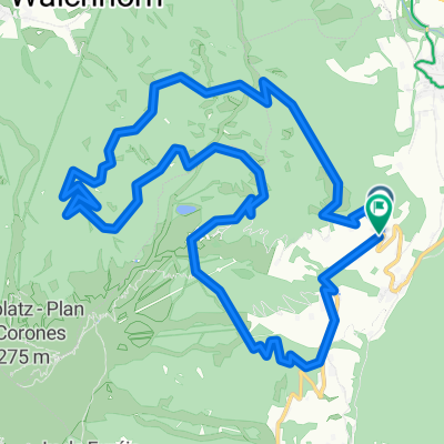
Antholzer Höhentour ab Olang
A cycling route starting in Olang, Trentino-Alto Adige, Italy.
Overview
About this route
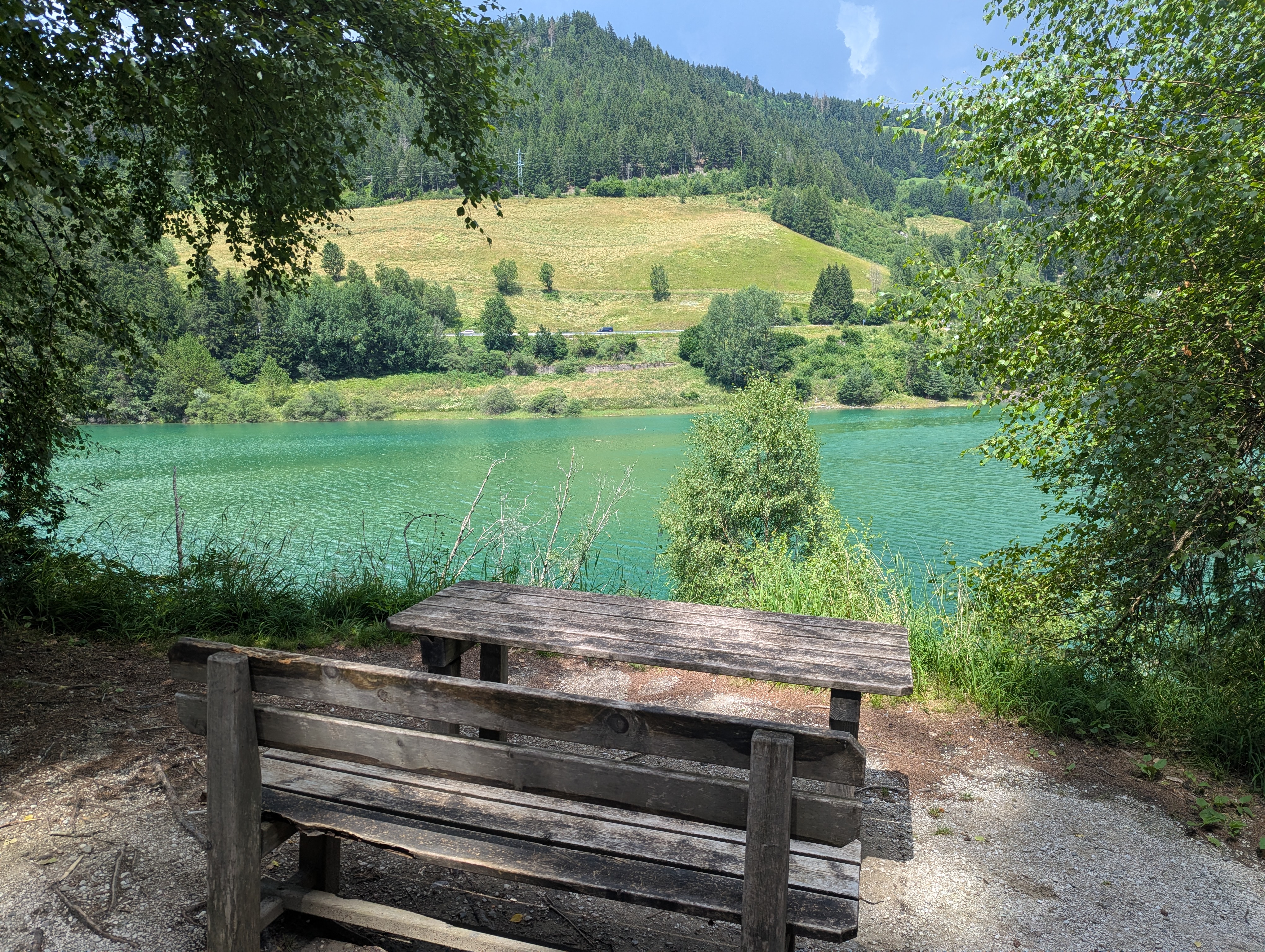
The tour starts in Olang. Follow the Antholzer stream to warm up your legs until Antholz-Niedertal. Then head up along trails No. 36 and 31. At first, the path is paved, but soon the surface changes. By kilometer 13 at the latest, the fun is over and depending on your fitness, you'll be pushing your bike (sweating and/or cursing). At forks, simply follow route No. 31 towards Taistner Hinteralm. Once at the top, just enjoy the highest point of the tour. Then it's up and down along the mountain ridge. From Brunner Wiesen (rest spot), the descent begins and you lose elevation. From Mudlerhof (another rest spot), follow route No. 21 and descend via Lottosteig back to the Puster Valley and Olang.
- -:--
- Duration
- 37 km
- Distance
- 1,461 m
- Ascent
- 1,181 m
- Descent
- ---
- Avg. speed
- 1,978 m
- Max. altitude

Route quality
Waytypes & surfaces along the route
Waytypes
Track
23.3 km
(63 %)
Quiet road
10 km
(27 %)
Surfaces
Paved
9.2 km
(25 %)
Unpaved
22.6 km
(61 %)
Gravel
20.7 km
(56 %)
Asphalt
8.5 km
(23 %)
Route highlights
Points of interest along the route

Point of interest after 20.4 km

Point of interest after 24.7 km
Blick zum Kronplatz

Point of interest after 31.2 km
Blick auf den Olanger-See
Continue with Bikemap
Use, edit, or download this cycling route
You would like to ride Antholzer Höhentour ab Olang or customize it for your own trip? Here is what you can do with this Bikemap route:
Free features
- Save this route as favorite or in collections
- Copy & plan your own version of this route
- Sync your route with Garmin or Wahoo
Premium features
Free trial for 3 days, or one-time payment. More about Bikemap Premium.
- Navigate this route on iOS & Android
- Export a GPX / KML file of this route
- Create your custom printout (try it for free)
- Download this route for offline navigation
Discover more Premium features.
Get Bikemap PremiumFrom our community
Other popular routes starting in Olang
 Route nach Via Polo Stegona Marco
- Distance
- 14.8 km
- Ascent
- 48 m
- Descent
- 329 m
- Location
- Olang, Trentino-Alto Adige, Italy
 Kronplatz-Tour (Olang - Kronplatz)
- Distance
- 14.7 km
- Ascent
- 1,277 m
- Descent
- 55 m
- Location
- Olang, Trentino-Alto Adige, Italy
 Klammljoch - Staller Sattel
- Distance
- 92.8 km
- Ascent
- 1,955 m
- Descent
- 1,955 m
- Location
- Olang, Trentino-Alto Adige, Italy
 Route in Olang
- Distance
- 18.5 km
- Ascent
- 1,143 m
- Descent
- 1,141 m
- Location
- Olang, Trentino-Alto Adige, Italy
 Staller Sattel
- Distance
- 148.7 km
- Ascent
- 2,518 m
- Descent
- 2,424 m
- Location
- Olang, Trentino-Alto Adige, Italy
 3 Almen
- Distance
- 26.8 km
- Ascent
- 1,620 m
- Descent
- 1,620 m
- Location
- Olang, Trentino-Alto Adige, Italy
 Via Pracken, Valdaora to Via Furcia, Valdaora
- Distance
- 9.7 km
- Ascent
- 540 m
- Descent
- 598 m
- Location
- Olang, Trentino-Alto Adige, Italy
 Via Hans Von Perthaler 8a nach St.Veit
- Distance
- 19.5 km
- Ascent
- 717 m
- Descent
- 236 m
- Location
- Olang, Trentino-Alto Adige, Italy
Open it in the app