

D Saarland Ormesheim MTB Katharinenhof
A cycling route starting in Gersheim, Saarland, Germany.
Overview
About this route
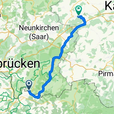
Ormesheim - Ommersheim - Biesingen - Bellevue - Katharinenhof - Bellevue - Biesingen - Aßweiler - Ommersheim - Ormesheim
Just after KM 1 (near Ormesheim) and again after KM 30 (near Ormesheim), there is a meadow crossing that should only be ridden with wider tires!
Between KM 15 and KM 20 (at least in or after bad weather) it is only passable with an MTB!
- -:--
- Duration
- 31.6 km
- Distance
- 231 m
- Ascent
- 232 m
- Descent
- ---
- Avg. speed
- ---
- Max. altitude
Route quality
Waytypes & surfaces along the route
Waytypes
Track
21.8 km
(69 %)
Quiet road
4.4 km
(14 %)
Surfaces
Paved
15.1 km
(48 %)
Unpaved
13.6 km
(43 %)
Gravel
10.7 km
(34 %)
Asphalt
9.5 km
(30 %)
Continue with Bikemap
Use, edit, or download this cycling route
You would like to ride D Saarland Ormesheim MTB Katharinenhof or customize it for your own trip? Here is what you can do with this Bikemap route:
Free features
- Save this route as favorite or in collections
- Copy & plan your own version of this route
- Sync your route with Garmin or Wahoo
Premium features
Free trial for 3 days, or one-time payment. More about Bikemap Premium.
- Navigate this route on iOS & Android
- Export a GPX / KML file of this route
- Create your custom printout (try it for free)
- Download this route for offline navigation
Discover more Premium features.
Get Bikemap PremiumFrom our community
Other popular routes starting in Gersheim
 TT Bliestal
- Distance
- 16 km
- Ascent
- 287 m
- Descent
- 290 m
- Location
- Gersheim, Saarland, Germany
 D Saarland Ormesheim MTB Katharinenhof
- Distance
- 31.6 km
- Ascent
- 231 m
- Descent
- 232 m
- Location
- Gersheim, Saarland, Germany
 Erfweiler-Sarregemines
- Distance
- 33.1 km
- Ascent
- 187 m
- Descent
- 187 m
- Location
- Gersheim, Saarland, Germany
 Mandelbachtal kleine Rundfahrt
- Distance
- 34.2 km
- Ascent
- 464 m
- Descent
- 463 m
- Location
- Gersheim, Saarland, Germany
 Ormesheim nach Ormesheim
- Distance
- 31.6 km
- Ascent
- 431 m
- Descent
- 437 m
- Location
- Gersheim, Saarland, Germany
 2. Etappe Ombachsee
- Distance
- 52.3 km
- Ascent
- 330 m
- Descent
- 276 m
- Location
- Gersheim, Saarland, Germany
 Europäischer Mühlenradweg 2010 - 72 km Permanente des RSV Bliestal Gersheim e.V.
- Distance
- 57.2 km
- Ascent
- 522 m
- Descent
- 532 m
- Location
- Gersheim, Saarland, Germany
 Über die Maginotlinie 2010 - 75 km Permanente des RSV Bliestal Gersheim e.V.
- Distance
- 72.3 km
- Ascent
- 913 m
- Descent
- 894 m
- Location
- Gersheim, Saarland, Germany
Open it in the app