

09-MassifCentral
A cycling route starting in Laguiole, Occitanie, France.
Overview
About this route
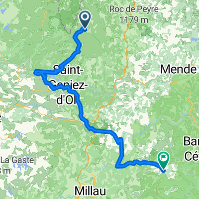
9. Etappe St. Urcize - La Carnourgue
- -:--
- Duration
- 60.8 km
- Distance
- 509 m
- Ascent
- 1,057 m
- Descent
- ---
- Avg. speed
- ---
- Max. altitude

Route quality
Waytypes & surfaces along the route
Waytypes
Road
30.4 km
(50 %)
Quiet road
2.4 km
(4 %)
Surfaces
Paved
53.5 km
(88 %)
Asphalt
53.5 km
(88 %)
Undefined
7.3 km
(12 %)
Continue with Bikemap
Use, edit, or download this cycling route
You would like to ride 09-MassifCentral or customize it for your own trip? Here is what you can do with this Bikemap route:
Free features
- Save this route as favorite or in collections
- Copy & plan your own version of this route
- Sync your route with Garmin or Wahoo
Premium features
Free trial for 3 days, or one-time payment. More about Bikemap Premium.
- Navigate this route on iOS & Android
- Export a GPX / KML file of this route
- Create your custom printout (try it for free)
- Download this route for offline navigation
Discover more Premium features.
Get Bikemap PremiumFrom our community
Other popular routes starting in Laguiole
 Route de Sainte-Urcize 21, Nasbinals nach Avenue Albert Thomas 23, Capdenac-Gare
- Distance
- 114 km
- Ascent
- 2,345 m
- Descent
- 3,338 m
- Location
- Laguiole, Occitanie, France
 2014 Ride Day 99 - St-Chély-d'Aubrac to Marvejols
- Distance
- 44.7 km
- Ascent
- 673 m
- Descent
- 856 m
- Location
- Laguiole, Occitanie, France
 TAP J 1
- Distance
- 78.4 km
- Ascent
- 900 m
- Descent
- 1,474 m
- Location
- Laguiole, Occitanie, France
 Aveyron-Tag1--4-0719 Runde angepasst 2
- Distance
- 138.5 km
- Ascent
- 1,438 m
- Descent
- 1,922 m
- Location
- Laguiole, Occitanie, France
 09-MassifCentral
- Distance
- 60.8 km
- Ascent
- 509 m
- Descent
- 1,057 m
- Location
- Laguiole, Occitanie, France
 Ride Day 32—13 Oct 2005—48260 Recoules D'Aubrac (Nasbinals) to 15300 Murat
- Distance
- 67.6 km
- Ascent
- 587 m
- Descent
- 757 m
- Location
- Laguiole, Occitanie, France
 7.etapa St Chely d Aubrac - Le Malzieu-Ville
- Distance
- 80.6 km
- Ascent
- 934 m
- Descent
- 877 m
- Location
- Laguiole, Occitanie, France
 JATIENZA2
- Distance
- 44.1 km
- Ascent
- 860 m
- Descent
- 858 m
- Location
- Laguiole, Occitanie, France
Open it in the app