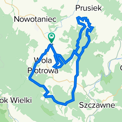
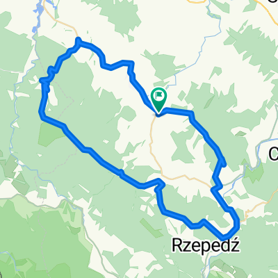
- 67.2 km
- 931 m
- 931 m
- Bukowsko, Subcarpathian Voivodeship, Poland
Bukowica - prze艂. Szklarska - Wis艂oczek
A cycling route starting in Bukowsko, Subcarpathian Voivodeship, Poland.
Overview
About this route
In the Low Beskids; From Tokarnia to Wola Piotrowa, via Bukowica on the yellow trail to Wis艂ok Wielki. From there, take the main road to Ja艣liska, then follow the old "Hungarian route" through the Szklarska Pass to Kr贸lik Polski and over the hill to Wis艂oczek. Descend to Pastwiska and through Nowotaniec back to Tokarnia.
- -:--
- Duration
- 67.2 km
- Distance
- 931 m
- Ascent
- 931 m
- Descent
- ---
- Avg. speed
- ---
- Max. altitude
created this 11 years ago
Route quality
Waytypes & surfaces along the route
Waytypes
Track
14.1 km
(21 %)
Quiet road
10.1 km
(15 %)
Surfaces
Paved
50.4 km
(75 %)
Unpaved
4.7 km
(7 %)
Asphalt
49.1 km
(73 %)
Gravel
4 km
(6 %)
Route highlights
Points of interest along the route
Point of interest after 38.1 km
ko艣ci贸艂 w Kr贸liku Polskim z 1754 r
Continue with Bikemap
Use, edit, or download this cycling route
You would like to ride Bukowica - prze艂. Szklarska - Wis艂oczek or customize it for your own trip? Here is what you can do with this Bikemap route:
Free features
- Save this route as favorite or in collections
- Copy & plan your own version of this route
- Sync your route with Garmin or Wahoo
Premium features
Free trial for 3 days, or one-time payment. More about Bikemap Premium.
- Navigate this route on iOS & Android
- Export a GPX / KML file of this route
- Create your custom printout (try it for free)
- Download this route for offline navigation
Discover more Premium features.
Get Bikemap PremiumFrom our community
Other popular routes starting in Bukowsko
- Bukowica - prze艂. Szklarska - Wis艂oczek
- Tokarnia - Wola S臋kowa -Nowotaniec - Tokarnia
- 18.5 km
- 221 m
- 221 m
- Bukowsko, Subcarpathian Voivodeship, Poland
- Tokarnia - TOKARNIA (778) - Tokarnia
- 12.9 km
- 386 m
- 386 m
- Bukowsko, Subcarpathian Voivodeship, Poland
- 2018.09.21 Beskid Niski 3/3 Bukowsko- Rzesz贸w
- 107.6 km
- 259 m
- 575 m
- Bukowsko, Subcarpathian Voivodeship, Poland
- 2011-04-16 Bieszczady: Chryszczata (998m), Prze艂臋cz 呕ebrak (816m), Prz臋艂臋cz Przys艂up (749m), Prze艂臋cz nad Roztokami (801m), Okr膮glik (1101), Jas艂o (1153)
- 87.2 km
- 1,432 m
- 1,386 m
- Bukowsko, Subcarpathian Voivodeship, Poland
- Bukowsko Half
- 48.1 km
- 1,418 m
- 1,416 m
- Bukowsko, Subcarpathian Voivodeship, Poland
- Bukowica, Tokarnia, Rzepedka, Jworzynka
- 57.2 km
- 1,085 m
- 1,088 m
- Bukowsko, Subcarpathian Voivodeship, Poland
- Bukowsko - Tokarnia - Jasiel
- 78.7 km
- 833 m
- 836 m
- Bukowsko, Subcarpathian Voivodeship, Poland
Open it in the app


