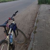
Cycle in Thai 04 : North-East
A cycling route starting in Vientiane, Vientiane Prefecture, Laos.
Overview
About this route
<span style="color: rgb(51, 51, 51); font-family: 'Helvetica Neue', Helvetica, Arial, 'hiragino kaku gothic pro', meiryo, 'ms pgothic', sans-serif; font-size: 14px; line-height: 20px;">04th: 2007/03/20 - 23 ( 375km )</span><br style="color: rgb(51, 51, 51); font-family: 'Helvetica Neue', Helvetica, Arial, 'hiragino kaku gothic pro', meiryo, 'ms pgothic', sans-serif; font-size: 14px; line-height: 20px;" /> <span style="color: rgb(51, 51, 51); font-family: 'Helvetica Neue', Helvetica, Arial, 'hiragino kaku gothic pro', meiryo, 'ms pgothic', sans-serif; font-size: 14px; line-height: 20px;">Viantiane (Laos) --> หนองคาย (Nong Khai) --> อุดรธานี (Udon Thani) --></span><span style="color: rgb(51, 51, 51); font-family: 'Helvetica Neue', Helvetica, Arial, 'hiragino kaku gothic pro', meiryo, 'ms pgothic', sans-serif; font-size: 14px; line-height: 20px;"> ขอนแก่น (Khon Kaen) --> พิมาย (Phimai)</span>
- -:--
- Duration
- 386.8 km
- Distance
- 298 m
- Ascent
- 317 m
- Descent
- ---
- Avg. speed
- ---
- Max. altitude
Continue with Bikemap
Use, edit, or download this cycling route
You would like to ride Cycle in Thai 04 : North-East or customize it for your own trip? Here is what you can do with this Bikemap route:
Free features
- Save this route as favorite or in collections
- Copy & plan your own version of this route
- Split it into stages to create a multi-day tour
- Sync your route with Garmin or Wahoo
Premium features
Free trial for 3 days, or one-time payment. More about Bikemap Premium.
- Navigate this route on iOS & Android
- Export a GPX / KML file of this route
- Create your custom printout (try it for free)
- Download this route for offline navigation
Discover more Premium features.
Get Bikemap PremiumFrom our community
Other popular routes starting in Vientiane
 LOcycle - Laos 1a
- Distance
- 78.1 km
- Ascent
- 162 m
- Descent
- 143 m
- Location
- Vientiane, Vientiane Prefecture, Laos
 Vientiane - Vang vieng - 186km
- Distance
- 186.3 km
- Ascent
- 277 m
- Descent
- 218 m
- Location
- Vientiane, Vientiane Prefecture, Laos
 Vientiane - Nam Lik Ecovillage
- Distance
- 100.4 km
- Ascent
- 220 m
- Descent
- 203 m
- Location
- Vientiane, Vientiane Prefecture, Laos
 LA_Vientiane - Viengkeo
- Distance
- 192.6 km
- Ascent
- 329 m
- Descent
- 267 m
- Location
- Vientiane, Vientiane Prefecture, Laos
 Rue Francois Ngin, Vientiane to Rue Lao-Thai, Vientiane
- Distance
- 4.9 km
- Ascent
- 14 m
- Descent
- 10 m
- Location
- Vientiane, Vientiane Prefecture, Laos
 Laos 1
- Distance
- 67.9 km
- Ascent
- 87 m
- Descent
- 82 m
- Location
- Vientiane, Vientiane Prefecture, Laos
 Easy ride
- Distance
- 20.2 km
- Ascent
- 339 m
- Descent
- 186 m
- Location
- Vientiane, Vientiane Prefecture, Laos
 Vientiane to Meo Vac
- Distance
- 1,561.3 km
- Ascent
- 7,771 m
- Descent
- 6,952 m
- Location
- Vientiane, Vientiane Prefecture, Laos
Open it in the app


