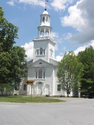
33.Tag C2C Amsterdam, NY - Brattleboro, VT
A cycling route starting in Amsterdam, New York, United States.
Overview
About this route
Zunächst wieder eine flache Fahrt bis Troy, dann aber sehr anstregende Fahrt durch die Green Mountains von Vermont
- -:--
- Duration
- 164.5 km
- Distance
- 1,278 m
- Ascent
- 1,278 m
- Descent
- ---
- Avg. speed
- ---
- Max. altitude
Route highlights
Points of interest along the route

Photo after 50 km

Photo after 100 km

Photo after 150.7 km
Continue with Bikemap
Use, edit, or download this cycling route
You would like to ride 33.Tag C2C Amsterdam, NY - Brattleboro, VT or customize it for your own trip? Here is what you can do with this Bikemap route:
Free features
- Save this route as favorite or in collections
- Copy & plan your own version of this route
- Split it into stages to create a multi-day tour
- Sync your route with Garmin or Wahoo
Premium features
Free trial for 3 days, or one-time payment. More about Bikemap Premium.
- Navigate this route on iOS & Android
- Export a GPX / KML file of this route
- Create your custom printout (try it for free)
- Download this route for offline navigation
Discover more Premium features.
Get Bikemap PremiumFrom our community
Other popular routes starting in Amsterdam
 Route to 543–549 Queen Anne Rd, Amsterdam
- Distance
- 19.7 km
- Ascent
- 114 m
- Descent
- 110 m
- Location
- Amsterdam, New York, United States
 Day 7
Day 7- Distance
- 75.9 km
- Ascent
- 263 m
- Descent
- 336 m
- Location
- Amsterdam, New York, United States
 800–984 NY-5S, Amsterdam to 100–116 Glen Dr, Fultonville
- Distance
- 21.8 km
- Ascent
- 143 m
- Descent
- 135 m
- Location
- Amsterdam, New York, United States
 Amststerdam to Saratoga Springs
- Distance
- 52.8 km
- Ascent
- 276 m
- Descent
- 280 m
- Location
- Amsterdam, New York, United States
 Washout Road 8-18-12
- Distance
- 33.2 km
- Ascent
- 301 m
- Descent
- 301 m
- Location
- Amsterdam, New York, United States
 Schoharie Crossing and Amsterdam Castle
- Distance
- 17.1 km
- Ascent
- 153 m
- Descent
- 153 m
- Location
- Amsterdam, New York, United States
 1375 NY-5S, Amsterdam to Ashmore Ave, Schenectady
- Distance
- 30.6 km
- Ascent
- 127 m
- Descent
- 122 m
- Location
- Amsterdam, New York, United States
 New York 5S 725, Amsterdam to New York 5S 1351, Amsterdam
- Distance
- 6.2 km
- Ascent
- 66 m
- Descent
- 21 m
- Location
- Amsterdam, New York, United States
Open it in the app


