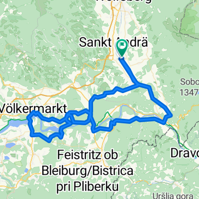
Kleine Lavanttal Runde
A cycling route starting in Sankt Andrä, Carinthia, Austria.
Overview
About this route
Relatively flat route with some short climbs
- -:--
- Duration
- 61.8 km
- Distance
- 441 m
- Ascent
- 441 m
- Descent
- ---
- Avg. speed
- ---
- Max. altitude
Route quality
Waytypes & surfaces along the route
Waytypes
Road
4.3 km
(7 %)
Quiet road
3.1 km
(5 %)
Surfaces
Paved
16.1 km
(26 %)
Asphalt
15.4 km
(25 %)
Paved (undefined)
0.6 km
(1 %)
Undefined
45.7 km
(74 %)
Continue with Bikemap
Use, edit, or download this cycling route
You would like to ride Kleine Lavanttal Runde or customize it for your own trip? Here is what you can do with this Bikemap route:
Free features
- Save this route as favorite or in collections
- Copy & plan your own version of this route
- Sync your route with Garmin or Wahoo
Premium features
Free trial for 3 days, or one-time payment. More about Bikemap Premium.
- Navigate this route on iOS & Android
- Export a GPX / KML file of this route
- Create your custom printout (try it for free)
- Download this route for offline navigation
Discover more Premium features.
Get Bikemap PremiumFrom our community
Other popular routes starting in Sankt Andrä
- Eitweg Ruden Bleiburg Loibach
- Distance
- 36.7 km
- Ascent
- 425 m
- Descent
- 407 m
- Location
- Sankt Andrä, Carinthia, Austria
- 70.3 Triathlon Intern Laufstrecke Teil 1
- Distance
- 7.6 km
- Ascent
- 12 m
- Descent
- 12 m
- Location
- Sankt Andrä, Carinthia, Austria
- 70.3 Triathlon Intern Laufstrecke Teil 2
- Distance
- 6.1 km
- Ascent
- 8 m
- Descent
- 8 m
- Location
- Sankt Andrä, Carinthia, Austria
- Griffner Runde
- Distance
- 48.3 km
- Ascent
- 755 m
- Descent
- 754 m
- Location
- Sankt Andrä, Carinthia, Austria
- Wolkersdorf-Reisbergerhütte- Pöllingerhütte-Pölling-Wolkersdorf
- Distance
- 41 km
- Ascent
- 1,229 m
- Descent
- 1,229 m
- Location
- Sankt Andrä, Carinthia, Austria
- MTB-Tour über Diex
- Distance
- 79 km
- Ascent
- 1,918 m
- Descent
- 1,918 m
- Location
- Sankt Andrä, Carinthia, Austria
- Lavant_Drau_Vkmkt
- Distance
- 93.3 km
- Ascent
- 595 m
- Descent
- 593 m
- Location
- Sankt Andrä, Carinthia, Austria
- Leiwald-Klippitztörltour
- Distance
- 66.4 km
- Ascent
- 1,508 m
- Descent
- 1,506 m
- Location
- Sankt Andrä, Carinthia, Austria
Open it in the app