

Matschrunde um Weilburg
A cycling route starting in Weinbach, Hesse, Germany.
Overview
About this route
Only suitable for MTB - duration about 1:30 if wet.
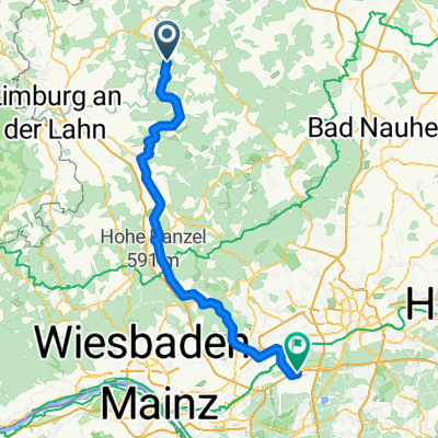
Initially on the Lahnhöhenweg towards Kischhofen (the purest mud battle). At times riding was impossible...
In Kirschhofen over the Lahn and further towards Weilburg on good paved paths.
From Weilburg through Ahausen to Windhof - through the industrial area in Kubach past the crystal cave back to Freienfels.
- -:--
- Duration
- 21.6 km
- Distance
- 332 m
- Ascent
- 335 m
- Descent
- ---
- Avg. speed
- ---
- Max. altitude

Continue with Bikemap
Use, edit, or download this cycling route
You would like to ride Matschrunde um Weilburg or customize it for your own trip? Here is what you can do with this Bikemap route:
Free features
- Save this route as favorite or in collections
- Copy & plan your own version of this route
- Sync your route with Garmin or Wahoo
Premium features
Free trial for 3 days, or one-time payment. More about Bikemap Premium.
- Navigate this route on iOS & Android
- Export a GPX / KML file of this route
- Create your custom printout (try it for free)
- Download this route for offline navigation
Discover more Premium features.
Get Bikemap PremiumFrom our community
Other popular routes starting in Weinbach
 Lahntaltour 2. Tag
- Distance
- 42.6 km
- Ascent
- 214 m
- Descent
- 304 m
- Location
- Weinbach, Hesse, Germany
 Radstrecke Weilburgman 2014 Runde ab/bis Freienfels
- Distance
- 22.5 km
- Ascent
- 246 m
- Descent
- 248 m
- Location
- Weinbach, Hesse, Germany
 MTB mit Single Trails auf Lahn Wanderwegen
- Distance
- 54.5 km
- Ascent
- 640 m
- Descent
- 639 m
- Location
- Weinbach, Hesse, Germany
 Freienfels-FRA BG3-via Idstein
- Distance
- 73.2 km
- Ascent
- 507 m
- Descent
- 550 m
- Location
- Weinbach, Hesse, Germany
 MTB Freienfels-Braunfels-Weilburg
- Distance
- 40.3 km
- Ascent
- 523 m
- Descent
- 529 m
- Location
- Weinbach, Hesse, Germany
 Tiefenbach
- Distance
- 42.2 km
- Ascent
- 531 m
- Descent
- 526 m
- Location
- Weinbach, Hesse, Germany
 Gräveneck-Kerkerbach-Hintermeilingen
- Distance
- 36 km
- Ascent
- 477 m
- Descent
- 429 m
- Location
- Weinbach, Hesse, Germany
 MTB 40k um Merenberg 500hm
- Distance
- 40 km
- Ascent
- 552 m
- Descent
- 550 m
- Location
- Weinbach, Hesse, Germany
Open it in the app