

Mostly offroad (Warta)
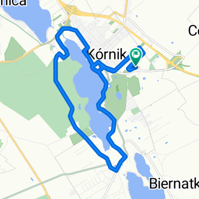
A cycling route starting in Kórnik, Greater Poland Voivodeship, Poland.
Overview
About this route
głównie wałami powodziowymi wzdłuż Warty
- -:--
- Duration
- 95.6 km
- Distance
- 104 m
- Ascent
- 104 m
- Descent
- ---
- Avg. speed
- ---
- Max. altitude

Route quality
Waytypes & surfaces along the route
Waytypes
Track
34.4 km
(36 %)
Road
25.8 km
(27 %)
Surfaces
Paved
25.8 km
(27 %)
Unpaved
33.5 km
(35 %)
Asphalt
25.8 km
(27 %)
Gravel
16.2 km
(17 %)
Continue with Bikemap
Use, edit, or download this cycling route
You would like to ride Mostly offroad (Warta) or customize it for your own trip? Here is what you can do with this Bikemap route:
Free features
- Save this route as favorite or in collections
- Copy & plan your own version of this route
- Split it into stages to create a multi-day tour
- Sync your route with Garmin or Wahoo
Premium features
Free trial for 3 days, or one-time payment. More about Bikemap Premium.
- Navigate this route on iOS & Android
- Export a GPX / KML file of this route
- Create your custom printout (try it for free)
- Download this route for offline navigation
Discover more Premium features.
Get Bikemap PremiumFrom our community
Other popular routes starting in Kórnik
 Lokalne nabijanie kilosów
- Distance
- 34.7 km
- Ascent
- 87 m
- Descent
- 87 m
- Location
- Kórnik, Greater Poland Voivodeship, Poland
 Sobotnie otwarcie
- Distance
- 17.8 km
- Ascent
- 32 m
- Descent
- 33 m
- Location
- Kórnik, Greater Poland Voivodeship, Poland
 Pogorzelica-przeprawa
- Distance
- 107.7 km
- Ascent
- 154 m
- Descent
- 154 m
- Location
- Kórnik, Greater Poland Voivodeship, Poland
 Almost Springtime
- Distance
- 28.8 km
- Ascent
- 39 m
- Descent
- 36 m
- Location
- Kórnik, Greater Poland Voivodeship, Poland
 Bnin - Hermanów
- Distance
- 62.1 km
- Ascent
- 101 m
- Descent
- 97 m
- Location
- Kórnik, Greater Poland Voivodeship, Poland
 Kórnik-Zaniemyśl-Środa-Śródka-Kórnik
- Distance
- 55.7 km
- Ascent
- 65 m
- Descent
- 65 m
- Location
- Kórnik, Greater Poland Voivodeship, Poland
 Powolna trasa w Kórnik
- Distance
- 12 km
- Ascent
- 73 m
- Descent
- 72 m
- Location
- Kórnik, Greater Poland Voivodeship, Poland
 Kórnik - Zaniemyśl - Czmoniec
- Distance
- 55.2 km
- Ascent
- 97 m
- Descent
- 97 m
- Location
- Kórnik, Greater Poland Voivodeship, Poland
Open it in the app