

Plassenburg - Markgrafgenweg Goldkronach-Bayreuth-Kulmbach
A cycling route starting in Goldkronach, Bavaria, Germany.
Overview
About this route
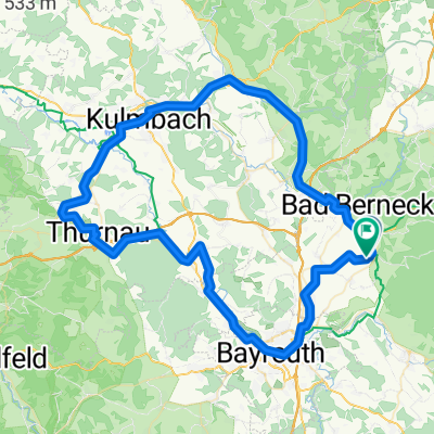
From Goldkronach via BT to the Margrave Trail starting at the Victory Tower, through Pechgraben, Waldau, Tennach back to the Plassenburg via Trebgast, Oberlaitsch, Altenreuth, Benk Goldkronach.
It was really good and beautiful too : )
- -:--
- Duration
- 66.2 km
- Distance
- 849 m
- Ascent
- 846 m
- Descent
- ---
- Avg. speed
- ---
- Max. altitude

Route quality
Waytypes & surfaces along the route
Waytypes
Track
35.7 km
(54 %)
Quiet road
14.6 km
(22 %)
Surfaces
Paved
17.2 km
(26 %)
Unpaved
36.4 km
(55 %)
Gravel
19.8 km
(30 %)
Asphalt
15.2 km
(23 %)
Continue with Bikemap
Use, edit, or download this cycling route
You would like to ride Plassenburg - Markgrafgenweg Goldkronach-Bayreuth-Kulmbach or customize it for your own trip? Here is what you can do with this Bikemap route:
Free features
- Save this route as favorite or in collections
- Copy & plan your own version of this route
- Sync your route with Garmin or Wahoo
Premium features
Free trial for 3 days, or one-time payment. More about Bikemap Premium.
- Navigate this route on iOS & Android
- Export a GPX / KML file of this route
- Create your custom printout (try it for free)
- Download this route for offline navigation
Discover more Premium features.
Get Bikemap PremiumFrom our community
Other popular routes starting in Goldkronach
 The "T"...rails
- Distance
- 58 km
- Ascent
- 1,192 m
- Descent
- 1,192 m
- Location
- Goldkronach, Bavaria, Germany
 Oberpfälzer Runde
- Distance
- 152.7 km
- Ascent
- 1,260 m
- Descent
- 1,276 m
- Location
- Goldkronach, Bavaria, Germany
 Rundum
- Distance
- 12.7 km
- Ascent
- 303 m
- Descent
- 478 m
- Location
- Goldkronach, Bavaria, Germany
 Kulmbach bt
- Distance
- 82.8 km
- Ascent
- 753 m
- Descent
- 753 m
- Location
- Goldkronach, Bavaria, Germany
 Ostertour
- Distance
- 61.6 km
- Ascent
- 486 m
- Descent
- 486 m
- Location
- Goldkronach, Bavaria, Germany
 Rund um Bayreuth
- Distance
- 106.6 km
- Ascent
- 1,246 m
- Descent
- 1,243 m
- Location
- Goldkronach, Bavaria, Germany
 Goldkronach zum Ochsenkopf
- Distance
- 54.6 km
- Ascent
- 1,398 m
- Descent
- 1,369 m
- Location
- Goldkronach, Bavaria, Germany
 Moosbachsteig (Gustavsruhe) - Jägersteig - Trailrunde
- Distance
- 31.3 km
- Ascent
- 807 m
- Descent
- 807 m
- Location
- Goldkronach, Bavaria, Germany
Open it in the app