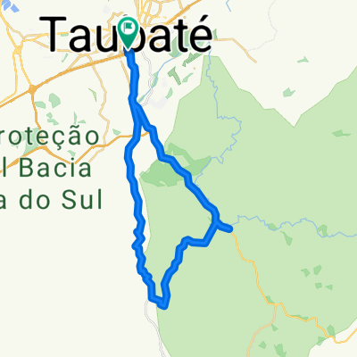
Caeiras-remedio
A cycling route starting in Taubaté, São Paulo, Brazil.
Overview
About this route
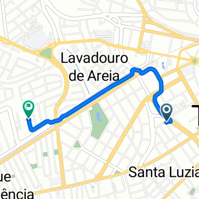
Caeiras-Remedios (Classico Taubaté)
- -:--
- Duration
- 16.7 km
- Distance
- 205 m
- Ascent
- 212 m
- Descent
- ---
- Avg. speed
- ---
- Max. altitude
Route quality
Waytypes & surfaces along the route
Waytypes
Quiet road
4.2 km
(25 %)
Road
2.3 km
(14 %)
Undefined
10.2 km
(61 %)
Surfaces
Paved
13 km
(78 %)
Asphalt
12.8 km
(77 %)
Paved (undefined)
0.2 km
(1 %)
Undefined
3.7 km
(22 %)
Continue with Bikemap
Use, edit, or download this cycling route
You would like to ride Caeiras-remedio or customize it for your own trip? Here is what you can do with this Bikemap route:
Free features
- Save this route as favorite or in collections
- Copy & plan your own version of this route
- Sync your route with Garmin or Wahoo
Premium features
Free trial for 3 days, or one-time payment. More about Bikemap Premium.
- Navigate this route on iOS & Android
- Export a GPX / KML file of this route
- Create your custom printout (try it for free)
- Download this route for offline navigation
Discover more Premium features.
Get Bikemap PremiumFrom our community
Other popular routes starting in Taubaté
- Easy ride
- Distance
- 36.6 km
- Ascent
- 283 m
- Descent
- 286 m
- Location
- Taubaté, São Paulo, Brazil
- Baracéia/Barreiro
- Distance
- 32.7 km
- Ascent
- 310 m
- Descent
- 307 m
- Location
- Taubaté, São Paulo, Brazil
- Tremembé, CicloturÃstica, Piracuama
- Distance
- 58.1 km
- Ascent
- 639 m
- Descent
- 657 m
- Location
- Taubaté, São Paulo, Brazil
- Caeiras-remedio
- Distance
- 16.7 km
- Ascent
- 205 m
- Descent
- 212 m
- Location
- Taubaté, São Paulo, Brazil
- Volta de Caçapava Velha (Via Carvalho Pinto)
- Distance
- 41.3 km
- Ascent
- 259 m
- Descent
- 256 m
- Location
- Taubaté, São Paulo, Brazil
- Taubaté - Ubatuba
- Distance
- 93.5 km
- Ascent
- 993 m
- Descent
- 1,594 m
- Location
- Taubaté, São Paulo, Brazil
- Volta de Piracuama
- Distance
- 59.6 km
- Ascent
- 284 m
- Descent
- 285 m
- Location
- Taubaté, São Paulo, Brazil
- Volta do Serrinha
- Distance
- 33 km
- Ascent
- 423 m
- Descent
- 423 m
- Location
- Taubaté, São Paulo, Brazil
Open it in the app